geo.wikisort.org - Reservoir
Lake Tabanda (Russian: Табанда; Yakut: Табандьа) is a freshwater lake in the Moma District, Sakha Republic (Yakutia), Russia. [2][3]
| Lake Tabanda | |
|---|---|
| Табанда / Табандьа | |
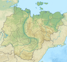 Lake Tabanda Location in Yakutia, Russian Far East | |
| Location | Chibagalakh Range Chersky Range East Siberian System |
| Coordinates | 66°19′5″N 140°01′10″E[1] |
| Primary outflows | Tabanda-Seene River |
| Catchment area | 125 km2 (48 sq mi) |
| Basin countries | Yakutia, Russia |
| Max. length | 10 km (6.2 mi) |
| Max. width | 1.4 km (0.87 mi) |
| Surface area | 11.2 km2 (4.3 sq mi) |
| Surface elevation | 1,239 m (4,065 ft) |
| Frozen | October to June |
It is one of the largest Alpine lakes of the Chersky Range system and is located in a desolate mountainous area where there are few visitors despite the beauty of the landscapes.
Geography
Lake Tabanda is a glacial lake that lies among high mountains at 1,239 m (4,065 ft) above mean sea level in the basin of the Chibagalakh River, part of the Indigirka basin. It is located at the head of the river in the northern slopes of the Chibagalakh Range.[4][5]
The Tabanda-Seene (Табанда-Сээнэ) river is the outflow of the lake. After its confluence with the Kanelibit, it gives origin to the Chibagalakh, a left hand tributary of the Indigirka.[2]
See also
- List of lakes of Russia
- Chersky Range
- Indigirka River
References
External links
This Sakha Republic location article is a stub. You can help Wikipedia by expanding it. |
Другой контент может иметь иную лицензию. Перед использованием материалов сайта WikiSort.org внимательно изучите правила лицензирования конкретных элементов наполнения сайта.
WikiSort.org - проект по пересортировке и дополнению контента Википедии