geo.wikisort.org - Reservoir
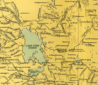
The Lake Ngapakaldi to Lake Palankarinna Fossil Area is a group of fossil sites located in the Australian state of South Australia within the Tirari Desert in the north-eastern part of the state's Far North region. The group has an overall area of 35 square kilometres (14 sq mi) and is located about 70 kilometres (43 mi) east of Lake Eyre and about 100 kilometres (62 mi) north-north-east of Marree, off the Birdsville Track near Etadunna Station.
Description
The area consists of four lakes grouped into two areas located about 40 kilometres (25 mi) apart.[1] They are surrounded by extensive areas of sand dunes in a flat, arid landscape. The lake beds are largely unvegetated and usually dry. Low cliffs on the western margins of the lakes have produced a variety of Tertiary vertebrate fossils ranging in age from the late Oligocene to the Pleistocene.[2]
Lakes Kununka, Ngapakaldi and Pitikanta
The following three lakes are located on the west side of the gazetted locality of Mulka with Lake Ngapakaldi being partly located within the locality of Lake Eyre:[1]
- Lake Kununka 28°23′S 138°18′E[3]
- Lake Pitikanta 28°21′S 138°18′E[3]
- Lake Ngapakaldi 28°17′S 138°17′E[3]
Lake Palankarinna
Lake Palankarinna 28°46′S 138°24′E is located in the gazetted locality of Etadunna on the west side of the Birdsville Track to the south of the other three sites.[3][1] The lake is part of a reserve known as the ‘Lake Palankarinna Fossil Reserve’ which consists of part of the western half of the lake bed and a parcel of land to the west.[1]
Status
The four sites are subject to a number of past and present heritage listings while one is located with a protected area:
- All four sites were listed as one entity on the now-defunct Register of the National Estate (No.5905) on 21 October 1980.[2]
- Lakes Kanunka, Pitikanta and Ngapakaldi has been listed as state heritage places on the South Australian Heritage Register since 1997.[4]
- Lake Ngapakaldi is also partly located within the Kati Thanda-Lake Eyre National Park.[4]
- Lake Palankarinna and some adjoining land has been gazetted since 1954 as a ‘fossil reserve’ under what is currently known as the Pastoral Land Management and Conservation Act 1989 in order to “prevent the exploitation for profit of these areas by non-scientists.”[5] The fossil reserve has also been listed as a ‘state heritage place’ since 1993.[1]
See also
- List of fossil parks
References
Notes
- "Search result for "Lake Palankarinna Fossil Reserve" with the following datasets selected - "Suburbs and Localities" and "SA Heritage Places Indicative Footprints"". Location SA Map Viewer. Government of South Australia. Retrieved 16 October 2016.
- Australian Heritage Database.
- Rich et al. (1982).
- "Lakes Kanunka, Pitikanta and Ngapakaldi (Lake Ngapakaldi partly located within Lake Eyre National Park) Tertiary Vertebrate Fossil Sites (designated place of palaeontological significance)". South Australian Heritage Register. Department of Environment, Water and Natural Resources. Archived from the original on 15 February 2016. Retrieved 12 February 2016.
- Morton et al, 1995, page 96
Sources
- Morton, S. R; Barker, R. D. (Robin Dale), 1940-; Doherty, M. D; CSIRO. Division of Wildlife and Ecology; Australia. World Heritage Unit (1995), Natural heritage values of the Lake Eyre Basin in South Australia : world heritage assessment (PDF), CSIRO Division of Wildlife and Ecology, archived from the original (PDF) on 8 March 2019, retrieved 26 September 2016
{{citation}}: CS1 maint: multiple names: authors list (link) - Rich, T.H.; Archer, M.; Plane, M.; Flannery, T.F.; Pledge, N.S.; Hand, S.; Rich, P.V. (1982). Australian Tertiary mammal localities. In: "The Fossil Vertebrate Record of Australasia", (ed P.V. Rich & E.M. Thompson). Melbourne: Monash University. pp. 525–572. ISBN 0-86746-153-5.
- "Lake Ngapakaldi to Lake Palankarinna Fossil Area". Australian Heritage Database. Australian Department of Sustainability, Environment, Water, Population and Communities. 22 September 2009. Retrieved 9 March 2011.
Further reading
- Pledge, Neville S.; & Prideaux, Gavin John. (1996). The natural history of the Lake Palankarinna fossil reserve. South Australian Museum: Adelaide.
- Monroe, M.H. "Australia: The Land Where Time Began. A biography of the Australian continent". Author. Retrieved 9 March 2011.
This South Australia geography article is a stub. You can help Wikipedia by expanding it. |
This paleontological site article is a stub. You can help Wikipedia by expanding it. |
This article about a specific Australian geological feature is a stub. You can help Wikipedia by expanding it. |
На других языках
- [en] Lake Ngapakaldi to Lake Palankarinna Fossil Area
[ru] Нгапакальди
Нгапакальди (англ. Lake Ngapakaldi to Lake Palankarinna Fossil Area) — совокупное название четырёх охраняемых территорий, расположенных в Южной Австралии в пустыне Тирари на северо-востоке штата в регионе Дальний Север. Общая площадь Нгапакальди — 35 км², он находится в 70 км к востоку от озера Эйр и примерно в 100 км на север-северо-восток от населённого пункта Марри[en].Другой контент может иметь иную лицензию. Перед использованием материалов сайта WikiSort.org внимательно изучите правила лицензирования конкретных элементов наполнения сайта.
WikiSort.org - проект по пересортировке и дополнению контента Википедии