geo.wikisort.org - Reservoir
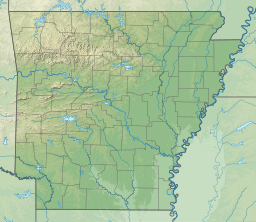
Lake Maumelle is a man-made lake in central Arkansas, United States, in Pulaski County, and covers 8,900 acres. It is one of the primary drinking water sources for Little Rock, Arkansas. It is locally popular for boating and fishing.
| Lake Maumelle | |
|---|---|
 Lake Maumelle | |
| Coordinates | 34°52′42″N 92°34′0″W |
| Basin countries | United States |
| Surface area | 8,900 acres (3,600 ha) |
| Shore length1 | 70 miles (110 km) |
| 1 Shore length is not a well-defined measure. | |
The lake was created in the late 1950s, with construction beginning in 1956 to dam the Big Maumelle River, and water flowing into the system in 1958.[1]
See also
- List of lakes in Arkansas
References
- Lake Maumelle (brochure, Central Arkansas Water, Retrieved 21 December 2012
External links
- Lake Maumelle at Arkansas.com
Authority control | |
|---|---|
| General |
|
| National libraries | |
На других языках
- [en] Lake Maumelle
[fr] Lac Maumelle
Le lac Maumelle est un lac de barrage créé par la construction d'un barrage sur la rivière rivière Maumelle en 1958. Ce lac artificiel est situé entièrement dans l'État de l'Arkansas aux États-Unis.Текст в блоке "Читать" взят с сайта "Википедия" и доступен по лицензии Creative Commons Attribution-ShareAlike; в отдельных случаях могут действовать дополнительные условия.
Другой контент может иметь иную лицензию. Перед использованием материалов сайта WikiSort.org внимательно изучите правила лицензирования конкретных элементов наполнения сайта.
Другой контент может иметь иную лицензию. Перед использованием материалов сайта WikiSort.org внимательно изучите правила лицензирования конкретных элементов наполнения сайта.
2019-2026
WikiSort.org - проект по пересортировке и дополнению контента Википедии
WikiSort.org - проект по пересортировке и дополнению контента Википедии