geo.wikisort.org - Reservoir
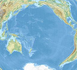
Lake Lalolalo (French: Lac Lalolalo) is a volcanic crater lake surrounded by jungle to the southwest of the island of Wallis (Uvea) in the Pacific. The largest lake on the island, it lies off Route 1 between the coastal village of Mala'etoli and Ahoa.[1] A small lake, Lake Lano, lies just to the northwest.
| Lake Lalolalo Lac Lalolalo | |
|---|---|
 | |
 Wallis map showing the lake at the left-middle of the island | |
| Location | Wallis, Wallis and Futuna |
| Coordinates | 13°18′0″S 176°14′2″W |
| Surface area | 15.2 ha (38 acres) |
| Average depth | 88.5 m (290 ft) |
Background and history
The lake, almost a perfect circle and the largest of several on the island, is important to local mythology of Wallis and Futuna and to historical disputes over territory.[2] The lake was also mentioned in Father Joseph Henquel's history.[3] There is a rumor that the US military dumped equipment in the lake at the end of World War II.[4] Scuba dives into the lake have found various calibers of dumped World War II era ammunition.[5]
Description
Lonely Planet says of it "Lake Lalolalo is the most spectacular of the Wallis crater lakes. The eerie lake is an almost perfect circle with sheer rocky cliffs falling 30m (98ft) down to the inky, 80m (262ft) deep waters."[6] The lake is also described as "circular, with vertical red walls 30 metres high, which make the pea-green water almost inaccessible"[7] Others claim its maximum depth is a little less at 76 metres.[8] The surrounding jungle is inhabited by tropical birds and flying foxes which regularly fly low over the lake.[9] The lake has a population of eels, which many conservationists have been concerned with due to the lake's inaccessibility.[8][10]
References
- Maps (Map). Google Maps.
- Burrows, Edwin Grant (1945). Songs of Uvea and Futuna. The Museum. p. 22. Retrieved 29 April 2012.
- Bernice Pauahi Bishop Museum (1937). Bernice P. Bishop Museum bulletin. Bishop Museum Press. p. 12. Retrieved 29 April 2012.
- McKinnon, Rowan (1 August 2009). South Pacific. Lonely Planet. p. 617. ISBN 978-1-74104-786-8. Retrieved 29 April 2012.
- Ellis Emmett. "Diving in Lake Created by Volcanic Activity - Over the Horizon". Outside TV. Archived from the original on 2021-12-14.
- "Lake Lalo Lalo". Lonely Planet. Retrieved 29 April 2012.
- Stanley, David (3 December 2004). Moon Handbooks South Pacific. David Stanley. p. 567. ISBN 978-1-56691-411-6. Retrieved 29 April 2012.
- Jost, Christian (1998). The French-speaking Pacific: population, environment and development issues. Boombana Publications. ISBN 978-1-876542-02-3. Retrieved 29 April 2012.
- Stanley, David (1996). South Pacific Handbook. David Stanley. p. 483. ISBN 978-1-56691-040-8. Retrieved 29 April 2012.
- Université de Paris. Station Biologique, Roscoff (1996). Cahiers de biologie marine. Éditions de la Station Biologique de Roscoff. p. 178. Retrieved 29 April 2012.
На других языках
- [en] Lake Lalolalo
[fr] Lac Lalolalo
Le lac Lalolalo est un lac situé à Wallis, une île française de Polynésie, dans l'océan Pacifique occidental. Avec une superficie de 15,2 hectares et 88,5 mètres de profondeur, ce lac de cratère constitue la plus grande étendue d'eau de Wallis-et-Futuna. De forme circulaire, il est entouré de falaises abruptes qui rendent son accès difficile. Le lac communique avec la mer à travers des failles souterraines, ce qui cause une différence de salinité entre les eaux profondes et les eaux douces de surface, qui ne se mélangent pas. Ces failles sont empruntées par des anguilles qui se retrouvent à l'âge adulte dans le lac. Il n'est peuplé que par deux autres espèces de poissons introduites dans les années 1960. Les eaux du lac sont très sombres et l'oxygène disparaît au-delà des 10 mètres de profondeur. On y trouve plusieurs espèces d'algues et de phytoplancton adaptées à ce milieu.[ru] Лалолало
Лалолало (фр. Lac Lalolalo) — вулканическое кратерное озеро, окружённое джунглями, к юго-западу от острова Увеа (Уоллис) в Тихом океане. Самое большое озеро на Увеа, находится у шоссе № 1 между прибрежными деревнями Малаэтоли и Ахоа. На северо-западе находится небольшое озеро Лано.Другой контент может иметь иную лицензию. Перед использованием материалов сайта WikiSort.org внимательно изучите правила лицензирования конкретных элементов наполнения сайта.
WikiSort.org - проект по пересортировке и дополнению контента Википедии
