geo.wikisort.org - Reservoir
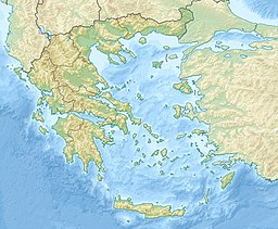
Lake Kournas is a lake on the island of Crete, Greece, near the village of Kournas. It is in the Apokoronas municipality of Chania regional unit close to the border with Rethymno regional unit, 47 km from the town of Chania. Kournas is a fairly large village perched on a hill overlooking the lake.

| Lake Kournas | |
|---|---|
 | |
| Location | Crete |
| Coordinates | 35°19′51″N 24°16′32″E |
| Type | alkali |
| Basin countries | Greece |

Crete's only freshwater lake, Lake Kournas, is relatively large, with a perimeter of 3.5 km. There is a nature preserve on the Southwest side of the lake. There is a rustic road from the North of the lake to the Hills on the West of the lake.
The lake used to be called Koresia after ancient Korion, a city thought to be in the area with a temple to Athena. The lake used to contain eels but now is better known for its terrapins and tourism.[citation needed] Tavernas and pedalo rental shops line part of the shore.
На других языках
[de] Kournas-See
Der Kournas-See (griechisch λίμνη κουρνά) ist der einzige natürliche Süßwassersee der griechischen Insel Kreta. Er liegt im Westen Kretas nahe der Nordküste in der Nähe von Georgioupoli. Der Abfluss des Sees mündet bei Georgioupolis in das Mittelmeer. Hier leben Wasserschildkröten, Schlangen und verschiedene Libellenarten. Als Freizeitangebot gibt es einen Tretbootverleih.- [en] Lake Kournas
[fr] Lac de Kournás
Le lac de Kournás (en grec moderne : Λίμνη Κουρνά) est un lac de Grèce, l'unique de Crète, situé près du village de Kournás, dans le nome de La Canée[1]. Situé à 5 km de la côte nord de l'île, près de Georgioúpoli, sa circonférence est de 3,5 km. Le lac se trouve entouré des Montagnes blanches et tire son nom de la localité de Kournás toute proche.[ru] Курна (озеро)
Курна́ или Курна́с (греч. λίμνη Κουρνά) — крупнейшее пресноводное озеро на острове Крит. Расположено на восточных склонах хребта Лефка-Ори, в 48 км к юго-востоку от города Ханья, близ города Георгиуполи. Окружность озера — около 3,5 км, площадь немногим более 1,2 км², наибольшая глубина — 25 м. Дно озера на 3 м ниже уровня моря. Из озера вытекает река Делфинас (греч. Δέλφινας).Другой контент может иметь иную лицензию. Перед использованием материалов сайта WikiSort.org внимательно изучите правила лицензирования конкретных элементов наполнения сайта.
WikiSort.org - проект по пересортировке и дополнению контента Википедии
