geo.wikisort.org - Reservoir
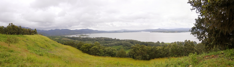
Lake Apanás is a reservoir located in northern Nicaragua and formed by Mancotal Dam on the Tuma River to the north of Jinotega department (border with Honduras). The reservoir has an area of 45.90 square kilometres.[2]
This article needs additional citations for verification. (September 2015) |
| Lake Apanás | |
|---|---|
 | |
 Lake Apanás | |
| Location | Jinotega, Nicaragua |
| Coordinates | 13°11′40″N 85°58′35″W |
| Type | reservoir |
| Primary inflows | Tuma River |
| Primary outflows | Tuma River |
| Basin countries | Nicaragua |
| Surface area | 45.90 km2 (17.72 sq mi) |
Ramsar Wetland | |
| Official name | Lago de Apanás-Asturias |
| Designated | 8 November 2001 |
| Reference no. | 1137[1] |
It is a source of much of nation's hydropower for the Centro América Power Plant.
References
- "Lago de Apanás-Asturias". Ramsar Sites Information Service. Retrieved 25 April 2018.
- Anuario Estadístico 2015 (PDF) (Report) (in Spanish). INIDE. February 2016. p. 6. Retrieved 1 December 2017.
This Nicaragua location article is a stub. You can help Wikipedia by expanding it. |
На других языках
- [en] Lake Apanás
[fr] Lac Apanás
Le lac Apanás, ou lac de Apanás-Asturias, est le premier lac artificiel du Nicaragua créé en 1964 par l'inondation de la vallée d'Apanás grâce à l'eau de la rivière Tuma retenue par le barrage de Mancotal. Il est situé dans la vallée de "La Cruz" dans le département de Jinotega à seulement 6 km de la ville de Jinotega.Текст в блоке "Читать" взят с сайта "Википедия" и доступен по лицензии Creative Commons Attribution-ShareAlike; в отдельных случаях могут действовать дополнительные условия.
Другой контент может иметь иную лицензию. Перед использованием материалов сайта WikiSort.org внимательно изучите правила лицензирования конкретных элементов наполнения сайта.
Другой контент может иметь иную лицензию. Перед использованием материалов сайта WikiSort.org внимательно изучите правила лицензирования конкретных элементов наполнения сайта.
2019-2025
WikiSort.org - проект по пересортировке и дополнению контента Википедии
WikiSort.org - проект по пересортировке и дополнению контента Википедии