geo.wikisort.org - Reservoir
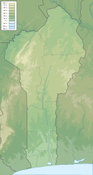
Lake Ahémé is Benin's second largest lake, with an area of 78 square kilometres (30 sq mi) in the dry season which expands to 100 square kilometres (39 sq mi) in the rainy season.[2] The lake is 24 kilometres (15 mi) long and has an average width of 3.6 kilometres (2.2 mi).[1] The Couffo River drains into the swampy north end of the lake, while the 10 km-long Aho Channel connects the lake's southern end to the Grand-Popo Lagoon on the Atlantic coast.[2] This channel flows south during the wet season but reverses direction in the dry season, which causes the salinity of the lake's southern end to increase.[2]
| Lake Ahémé | |
|---|---|
 Lake Ahémé | |
 Lake Ahémé | |
| Location | southwestern Benin |
| Coordinates | 6.495°N 1.975°E |
| Native name | Lac Ahémé (French) |
| Primary inflows | Couffo River |
| Primary outflows | Aho Channel |
| Basin countries | Benin |
| Max. length | 24 km (15 mi)[1] |
| Max. width | 5.5 km (3.4 mi)[1] |
| Surface area | 78–100 km2 (30–39 sq mi)[2] |
| Surface elevation | 3–5 m (9.8–16.4 ft)[1] |
| Settlements | Agatogbo, Agbanto, Akodéha, Bopa, Dekanmè, Kpomassè, Possotomè, Tokpa-Domè |
The Pedah and the Ayizo are the two main ethnic groups living on the shores of Lake Ahémé.[2][3] Fishing and agriculture are the main economic activities in the area.[1][2] In the lake, 71 species of fish have been recorded.[4][5]
The 47,500 hectares (117,000 acres) comprising the marshes of the lower Couffo, Lake Ahémé, the Aho Channel and the adjoining coastal lagoon have been designated as a Ramsar site[4] and an Important Bird Area.[6]
References
- Hughes, R. H.; Hughes, J. S. (1992). A directory of African wetlands. IUCN. ISBN 2-88032-949-3.
- Dangbégnon, Constant (2000). Governing Local Commons: What Can be Learned from the Failures of Lake Aheme's Institutions in Benin?. Eighth Biennial Conference of the International Association for the Study of Common Property. Bloomington, Indiana.
- Houngnikpo, Mathurin C.; Decalo, Samuel (2013). Historical Dictionary of Benin. Rowman & Littlefield. ISBN 978-0810871717. Retrieved 28 July 2016.
- "Basse Vallée du Couffo, Lagune Côtiere, Chenal Aho, Lac Ahémé". Retrieved 28 July 2016.
- "Présentation". Retrieved 28 July 2016.
- "Benin" (PDF). BirdLife International. Retrieved 28 July 2016.
На других языках
- [en] Lake Ahémé
[es] Lago Ahémé
El lago Ahémé es el segundo lago más grande de Benín, con un área de 78 km² en la estación seca que se expande hasta los 100 km² en la estación húmeda.[1] El lago tiene 24 km de longitud y una anchura media de 3,6 km.[2][fr] Lac Ahémé
Le lac Ahémé est alimenté par les eaux paresseuses de la rivière Couffo, qui rejoignent au sud celles du fleuve Mono, pour former un vaste delta aux environs de la Bouche du Roy. Le lac couvre une superficie d'environ 18 ha. Les villages riverains abritent une population vivant de la pêche et de l'agriculture. La pêche à l'acadja (pratiquée sur le lac Nokoué) s'est aussi développée sur ce lac, mais de manière plus limitée du fait de la présence de hauts-fonds[1].[ru] Аэме (озеро)
Аэме — второе по величине озеро Бенина. Оно имеет площадь 78 квадратных километров в сухой сезон и увеличивается до 100 квадратных километров в сезон дождей[2]. Озеро имеет длину 24 километра и среднюю ширину 3,6 километра[1]. Река Куффо[en] впадает в северный конец озера, а канал Ахо соединяет южный конец озера с городом Гран-Попо на побережье Атлантического океана[2]. Этот канал имеет южное направление во время сезона дождей, но меняет его в сухой сезон, что приводит к увеличению солености южного конца озера[2].Другой контент может иметь иную лицензию. Перед использованием материалов сайта WikiSort.org внимательно изучите правила лицензирования конкретных элементов наполнения сайта.
WikiSort.org - проект по пересортировке и дополнению контента Википедии