geo.wikisort.org - Reservoir
Lagoon Mirim (Portuguese, pronounced [miˈɾĩː]) or Merín (Spanish, pronounced [meˈɾin]) is a large estuarine lagoon which extends from southern Rio Grande do Sul state in Brazil into eastern Uruguay. Lagoa Mirim is separated from the Atlantic Ocean by a sandy, partially barren isthmus.
| Lagoon Mirim | |
|---|---|
 Lagoon Mirim | |
| Location | Brazil and Uruguay |
| Coordinates | 32°45′S 52°50′W |
| Type | estuarine lagoon |
| Primary outflows | São Gonçalo Channel |
| Max. length | 174 kilometres (108 mi) |
| Max. width | 10 to 35 km (6 to 22 mi) |
| Surface area | 3,750 km2 (1,450 sq mi) |
The Jaguarão/Yaguarón, Tacuarí and Cebollatí Rivers empty into Lagoon Mirim, while the São Gonçalo Channel connects it with Lagoa dos Patos to the north.
Location
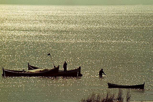
Lagoon Mirim is about 174 kilometres (108 mi) long by 10 to 35 km (6 to 22 mi) wide and 3,750 km2 (1,450 sq mi) in area. It is more irregular in outline than its larger neighbor to the north, Lagoa dos Patos, and discharges into the latter through São Gonçalo Channel, which is navigable by small boats. Lagoa Mirim has no direct connection to the Atlantic, but the Rio Grande, a tidal channel about 39 km (24 mi) long which connects Lagoon dos Patos to the Atlantic, affords an entrance to the navigable inland waters of both lagoons and several small ports. Both lagoons are the remains of an ancient depression in the coastline shut in by sand beaches built up by the combined action of wind and oceanic currents. They are at the same level as the ocean, but their waters are affected by the tides and are brackish only a short distance above the Rio Grande outlet.
The Taim Ecological Station lies to the east of the lagoon, in the narrow land strip between it and the Atlantic Ocean. The Jaguarão/Yaguarón River, which forms part of the Brazil-Uruguay boundary line, empties into Lagoon Mirim, and is navigable 42 km (26 mi) up to and beyond the twin towns of Jaguarão (Brazil) and Rio Branco (Uruguay). On the Uruguayan side apart from the Yaguarón River, the Cebollatí River and the Tacuarí River empty into the Lagoon Mirim. The amount of water received by the lagoon is greater from the Uruguayan side.
See also
- Topography and hydrography of Uruguay
- 1851 Boundary Treaty (Brazil–Uruguay)
- Jaguarão River#Navigability
Sources
This article incorporates text from a publication now in the public domain: Lamoureux, Andrew Jackson (1911). "Brazil". In Chisholm, Hugh (ed.). Encyclopædia Britannica. Vol. 4 (11th ed.). Cambridge University Press. pp. 439–442.
External links
| Wikimedia Commons has media related to Lake Merin. |
 | This geographical article relating to Rio Grande do Sul is a stub. You can help Wikipedia by expanding it. |
This article related to a lake or lagoon in Brazil is a stub. You can help Wikipedia by expanding it. |
This article related to a lake or lagoon in Uruguay is a stub. You can help Wikipedia by expanding it. |
На других языках
[de] Laguna Merín
Die Laguna Merín (auf portugiesisch: Lagoa Mirim) ist ein ausgedehnter See in Südamerika mit einer Fläche von 3750 km², durch den die Grenze zwischen Brasilien und Uruguay verläuft. Sein Name leitet sich von dem Wort mirĩ aus dem Tupí-Guaraní her, das „klein“ bedeutet. Uruguay hat einige Badeorte am Ufer des Sees, die über Sandstrände und geringe Wassertiefe verfügen.- [en] Lagoon Mirim
[fr] Lagoa Mirim
La lagoa Mirim (en français lagune Mirim ou en espagnol laguna Merín) est une lagune qui s'étend sur une aire de 3 994 km2, située sur la frontière entre le Brésil et l'Uruguay. Le canal San Gonzalo communique entre cette lagune et celle (plus grande) dite des Canards (Lagoa dos Patos). Les côtes de la lagune se caractérisent par des étendues de sols humides, comme le Banhado de Taim (marais de Taim), déclaré patrimoine naturel de l'humanité par l'UNESCO.[ru] Лагоа-Мирин
Лаго́а-Мири́н[3][1][4] (Мири́н[4]; исп. Laguna Merín[2], порт. Lagoa Mirim[4][2], букв. — маленькая лагуна[4]) — пресноводное озеро, расположенное на побережье Атлантического океана в южной части Бразилии и в восточной части Уругвая[5].Другой контент может иметь иную лицензию. Перед использованием материалов сайта WikiSort.org внимательно изучите правила лицензирования конкретных элементов наполнения сайта.
WikiSort.org - проект по пересортировке и дополнению контента Википедии