geo.wikisort.org - Reservoir
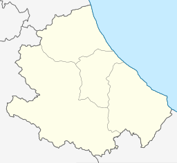
Lago di Bomba, also called Lago di Sangro, is a lake in the Province of Chieti, Abruzzo, Italy. At an elevation of 262 m, its surface area is about 2.5 km2 (0.97 sq mi). To the south of the lake is Villa Santa Maria and to the north of the lake is Bomba.[1]
| Lago di Bomba | |
|---|---|
 Lago di Bomba nestled under Monteferrante | |
 Lago di Bomba | |
| Location | Province of Chieti, Abruzzo |
| Coordinates | 42°N 14.362°E |
| Primary inflows | Sangro |
| Primary outflows | Sangro |
| Basin countries | Italy |
| Max. length | 5.7 km (3.5 mi) |
| Max. width | 0.8 km (0.50 mi) |
| Surface area | 2.5 km2 (0.97 sq mi) |
| Surface elevation | 262 m (860 ft) |
References
- The Times Comprehensive Atlas of the World (13 ed.). London: Times Books. 2011. p. 77 M4. ISBN 9780007419135.
This Abruzzo location article is a stub. You can help Wikipedia by expanding it. |
На других языках
- [en] Lago di Bomba
[fr] Lac de Bomba
Le lac de Bomba est un lac artificiel créé sur la rivière italienne Sangro par un barrage d'argile placé sur le territoire de la commune de Bomba. Le lac del Sangro est rarement indiqué sur les cartes.[it] Lago di Bomba
Il Lago di Bomba[1] così chiamato nella cartografia ufficiale[2] per via dell'ubicazione della diga, erroneamente indicato in alcune cartine come Lago del Sangro è un lago artificiale creato sul fiume Sangro da una diga in terra battuta posta sul territorio del comune di Bomba. Sulle sue sponde insistono i comuni di Atessa, Bomba, Colledimezzo, Pennadomo, Pietraferrazzana e Villa Santa Maria.Текст в блоке "Читать" взят с сайта "Википедия" и доступен по лицензии Creative Commons Attribution-ShareAlike; в отдельных случаях могут действовать дополнительные условия.
Другой контент может иметь иную лицензию. Перед использованием материалов сайта WikiSort.org внимательно изучите правила лицензирования конкретных элементов наполнения сайта.
Другой контент может иметь иную лицензию. Перед использованием материалов сайта WikiSort.org внимательно изучите правила лицензирования конкретных элементов наполнения сайта.
2019-2026
WikiSort.org - проект по пересортировке и дополнению контента Википедии
WikiSort.org - проект по пересортировке и дополнению контента Википедии