geo.wikisort.org - Reservoir
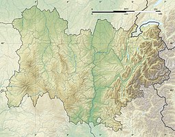
Lac des Sapins, literally translated into English as 'the lake of the fir-trees', is an artificial lake located in the region of Rhône-Alpes. It is situated 65 km northwest of the city of Lyon.
| Lac des Sapins | |
|---|---|
| Location | Cublize, Rhône |
| Coordinates | 46°0′25″N 4°22′15″E |
| Type | reservoir |
| Basin countries | France |
| Surface area | 40 ha (99 acres) |
| Shore length1 | 4.75 km (2.95 mi) |
| Surface elevation | 440 m (1,440 ft) |
| 1 Shore length is not a well-defined measure. | |
History
Construction of the lake began in the summer of 1967 by Louis Gueydon. The lake was built to try to develop the tourist industry in the region after a decline in industry in rural areas. In 1983, a camping park next to the lake was built with chalets, caravans etc. The investment proved to be successful, and in 1990 the camping park was extended, with the chalets and caravans upgraded or renovated. There were also multiple sports activities proposed (mountain biking, wind-surfing, volleyball and acrobranching).
External links
На других языках
- [en] Lac des Sapins
[fr] Lac des Sapins
Le lac des Sapins est un lac artificiel français situé sur les communes de Cublize et Ronno (Rhône), dans le Haut-Beaujolais, à 65 km au nord-ouest de Lyon et à 35 km à l'est de Roanne.Текст в блоке "Читать" взят с сайта "Википедия" и доступен по лицензии Creative Commons Attribution-ShareAlike; в отдельных случаях могут действовать дополнительные условия.
Другой контент может иметь иную лицензию. Перед использованием материалов сайта WikiSort.org внимательно изучите правила лицензирования конкретных элементов наполнения сайта.
Другой контент может иметь иную лицензию. Перед использованием материалов сайта WikiSort.org внимательно изучите правила лицензирования конкретных элементов наполнения сайта.
2019-2025
WikiSort.org - проект по пересортировке и дополнению контента Википедии
WikiSort.org - проект по пересортировке и дополнению контента Википедии
