geo.wikisort.org - Reservoir
La Paloma Dam re-directs here.
| La Paloma | |
|---|---|
| Lago La Paloma | |
 The reservoir as seen from Cerro Huatulame | |
 La Paloma | |
| Coordinates | 30°45′S 71°0′W[1] |
| Type | Irrigation reservoir |
| Primary inflows | Grande River |
| Primary outflows | Grande River |
| Basin countries | Chile |
| Surface area | 30 km2 (12 sq mi) |
| Water volume | 750×106 m3 (610,000 acre⋅ft) |
| References | [1] |
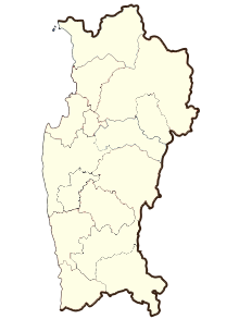
La Paloma is an artificial lake located 27 kilometres (17 mi) southeast of the city of Ovalle, in the Coquimbo Region, Chile. Although its primary purpose is to provide water for irrigation, the reservoir is also a popular recreational spot for locals and visitors. It was first inaugurated in 1968. It has an altitude of 328 metres (1,076 ft) [2]
References
- "GNS: Country Files". Archived from the original on 2012-05-04. Retrieved 2007-04-06.
- "Lago La Paloma". Mapcarta. Retrieved 2020-10-18.
External links
- Embalse La Paloma (in Spanish)
На других языках
- [en] La Paloma Lake
[es] Embalse La Paloma
El Embalse La Paloma es un embalse de agua localizado a 27 km al sureste de la ciudad de Ovalle, en la comuna de Monte Patria, Provincia del Limarí, Región de Coquimbo, Chile. Posee una capacidad de 750 millones de metros cúbicos y cubre una superficie de 3000 hectáreas. Embalsa las aguas del Río Grande y Río Huatulame. Es el embalse de riego más grande de Chile y el segundo más grande de Sudamérica.[2]:3Текст в блоке "Читать" взят с сайта "Википедия" и доступен по лицензии Creative Commons Attribution-ShareAlike; в отдельных случаях могут действовать дополнительные условия.
Другой контент может иметь иную лицензию. Перед использованием материалов сайта WikiSort.org внимательно изучите правила лицензирования конкретных элементов наполнения сайта.
Другой контент может иметь иную лицензию. Перед использованием материалов сайта WikiSort.org внимательно изучите правила лицензирования конкретных элементов наполнения сайта.
2019-2025
WikiSort.org - проект по пересортировке и дополнению контента Википедии
WikiSort.org - проект по пересортировке и дополнению контента Википедии
