geo.wikisort.org - Reservoir
LaDue Reservoir is a reservoir located near Ohio State Route 44 and U.S. Route 422 in Auburn and Troy Townships in Geauga County, Ohio. Originally called the “Akron City Reservoir”, it was dedicated as the LaDue Reservoir on October 11, 1961, in honor of Wendell R. LaDue.[3] The Geographic Names Information System recognized four variants names, including Akron City Reservoir, Bridge Creek Reservoir, Ladue Reservoir, and Wendell R. Ladue Reservoir.[1]
| LaDue Reservoir | |
|---|---|
 LaDue Reservoir Location of LaDue Reservoir in Ohio | |
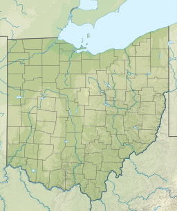
 USGS Map of LaDue Reservoir | |
| Location | Auburn Twp and Troy Township, Geauga County, Ohio |
| Coordinates | 41°23′19″N 81°11′50″W[1] |
| Type | reservoir |
| Primary inflows | Bridge Creek and Black Brook |
| Primary outflows | Bridge Creek and Black Brook |
| Catchment area | 42 sq mi (110 km2) |
| Basin countries | United States |
| Max. length | 5.5 mi (8.9 km) |
| Max. width | .15 to .8 mi (0.24 to 1.29 km) |
| Surface area | 1,477 acres (5.98 km2) |
| Max. depth | 21 ft (6.4 m) |
| Water volume | 18,100 acre⋅ft (22.3 hm3)[2] |
| Shore length1 | 24.3 mi (39.1 km) |
| Surface elevation | 1,127 ft (344 m) |
| 1 Shore length is not a well-defined measure. | |
The reservoir is formed by the Bridge Creek Dam 41°24′16″N 81°11′2″W[4] across Bridge Creek[5] and the Black Brook Dike 41°21′4″N 81°12′36″W[6] across Black Brook,[7] both tributaries of the Cuyahoga River.
The reservoir was created in an area that was covered with ice during the Wisconsinan glaciation and contains numerous glacial sand and gravel deposits (kames) and glacial ponds (kettles). The lake bottom retains the same irregularities found before it was dammed.[8]
Purpose
The reservoir and surrounding land is owned by the City of Akron, Ohio and is operated by Akron's Watershed Division.
The reservoir is one of three reservoirs that make up the City of Akron water supply, including LaDue Reservoir, East Branch Reservoir in Claridon Township, Geauga County, Ohio, and Lake Rockwell in Franklin Township, Portage County, Ohio.[9] The main purposes of these reservoirs are to provide flood control to downstream areas, replenish the river’s flow during dry periods, and maintain an ample supply of available drinking water for Akron.[9]
Because Lake Rockwell is the main drinking water supply for the City of Akron, it is highly protected with no trespassing, fishing, or recreation permitted.[9] However, both the East Branch Reservoir and the LaDue Reservoir are open to fishing, boating, and hunting. However, the Ohio Revised Code has special fishing regulations for LaDue Reservoir that do not allow gasoline motors on any watercraft, limit the size of electric motors, and restrict shoreline fishing to the right-of-ways along Ohio State Route 44, U.S. Route 422, and Auburn Road.[10]
Dams
Bridge Creek Dam
The Bridge Creek Dam 41°24′16″N 81°11′2″W,[4] also known as the LaDue Dam, is a rolled earth fill with impervious core, maximum height 35 ft, top length 3200 ft, top width 40 ft, base width about 120 ft and length 4500 ft. Spillway: Uncontrolled concrete lined saddle spillway that is 200 ft at the top and 250 ft near at the base. The drop is about 30 ft. The Bridge Creek Dam is a restricted zone with “No Trespassing Zone” signs on land and has marker buoys in the water.[11]
Black Brook Dike and dam
The Black Brook Dike is 100 ft wide and nearly 1.0 mi (1.6 km) long. It is located at the southern tip of the reservoir near the intersection of Bartholomew Road and Ohio State Route 44.[12]
The Black Brook Dam 41°21′4″N 81°12′36″W[6] is a rolled earth fill with impervious core, maximum height 20 ft, top length 325 ft, top width 30 ft, base width about 100 ft and length 1100 ft. It is located near the intersection of Crackel Road and Ohio State Route 44, about 1,500 ft (460 m) feet north of the Geauga-Portage County border.[13] It uses a 6 ft concrete drainage ditch to evacuate water. The Black Brook Dike and Dam are restricted zones with “No Trespassing Zone” signs posted on land and marker buoys in the water.[11]
Recreation
The LaDue Reservoir wildlife area includes 8,791 acres (3,558 ha) that protects the watershed of the east branch of the Cuyahoga River from the East Branch Reservoir at Headwaters Park in East Claridon, Ohio to Ohio State Route 82 in Mantua Township, Portage County, Ohio.[8]
For many years, the City of Akron managed recreation activities at its reservoirs. Since 2002, the Ohio Department of Natural Resources Division of Wildlife has managed the LaDue Public Hunting Area for the City of Akron, which includes hunting, trapping, boating, and fishing. The wildlife area includes diverse wildlife, including white-tailed deer, wild turkey, squirrel, rabbit, and woodchuck. Waterfowl include migrating mallards, wood duck, and Canada geese. LaDue Reservoir contains sport fish including walleye, largemouth bass, bluegill, yellow perch, white and black crappie, and channel catfish.[8]
Boating and fishing
Ohio Revised Code Chapter 1501:31-13 designates special fishing regulations for LaDue Reservoir that restrict watercraft to electric motors only and restrict shorelines fishing to the right-of-ways along Ohio State Route 44, U.S. Route 422, and Auburn Roads.[10] Fishing in Ohio requires a valid Ohio Fishing License and is subject to Ohio fishing regulations. No gasoline engines can be used on LaDue Reservoir.
ODNR Division of Wildlife maintains a gravel boat ramp with portable toilets near the intersection of East Washington Street and Valley Road.[14] There is also an unimproved boat ramp at the south end of the reservoir where Ohio State Route 44 crosses the reservoir. Boats are limited to electric motors only.
As of 2019, Breakaway Excursions began operating kayak and fishing boat rentals out of the La Due boathouse.
Hunting and trapping
Waterfowl hunting on LaDue Reservoir is limited to designated areas only and limited to hunters selected in an annual drawing held by the ODNR Division of Wildlife.[8] Hunting in Ohio is subject to hunting regulations.
Furbearer trapping is permitted throughout the area, however, it too requires a permit to trap beaver or river otter and is limited to trappers selected in an annual drawing by the Division of Wildlife.[8] Trapping in Ohio is subject to trapping regulations.
Environmental conditions
In 2010, excessive heat contributed to concerns for harmful algal blooms in many inland lakes in NE Ohio, including LaDue Reservoir. A harmful algal bloom occurs when naturally occurring blue-green algae, or cyanobacteria, produce neurotoxins, which affect the nervous system, and hepatotoxins, which affect the liver.[15] It is now monitored by the Ohio Department of Health.
See also
- Geauga Park District
- Ohio Department of Natural Resources
References
- "Geographic Names Information System entry for LaDue Reservoir". Retrieved 2011-09-11.
- "State of Ohio Ecological Assessment Unit" (PDF). Biological and Water Quality Study of the Cuyahoga River and Selected Tributaries: Volume 1 Geauga, Portage, Summit, and Cuyahoga Counties (Ohio). Environmental Protection Agency. Retrieved 2011-09-11.
- "Dedication of LaDue Reservoir"
- Geographic Names Information System. "GNIS entry for Bridge Creek Dam (Feature ID #1078935)". Retrieved 2011-09-11.
- Geographic Names Information System. "GNIS entry for Bridge Creek (Feature ID #1066093)". Retrieved 2011-09-11.
- Geographic Names Information System. "GNIS entry for Black Brook Dike (Feature ID # 1038070)". Retrieved 2011-09-11.
- Geographic Names Information System. "GNIS entry for Black Brook (Feature ID #1066584)". Retrieved 2011-09-11.
- "LaDue Public Hunting Area: Publication 316" (PDF). Division of Wildlife. Ohio Department of Natural Resources. Archived from the original (PDF) on 2012-04-02. Retrieved 2011-09-11.
- "Reservoirs". Watershed Management. City of Akron: Public Utilities. Archived from the original on 2012-03-26. Retrieved 2011-09-11.
- "Ohio Laws and Rules". Chapter 1501:31-13 Sport Fishing. State of Ohio. Retrieved 2011-09-11.
- "Wildlife Area Maps". LaDue Public Hunting Area. Ohio Department of Natural Resources. Retrieved 2011-09-11.
- "LaDue Reservoir". Access Geauga. Geauga County Auditor. Retrieved 2011-09-11.
- "Access Geauga". Black Brook Dam. Geauga County Auditor. Retrieved 2011-09-11.
- "Fishing Maps". LaDue Reservoir Fishing Map. Ohio Department of Natural Resources. Retrieved 2001-09-11.
- "HAB Historical Data". Algal blooms. Ohio Environmental Protection Agency. Retrieved 2011-09-11.
External links
- Google Maps Ladue Reservoir
- ODNR LaDue Reservoir Map
- ODNR LaDue Public Hunting Area: Publication 316
- LaDue Reservoir Fishing Map: Publication 264
Другой контент может иметь иную лицензию. Перед использованием материалов сайта WikiSort.org внимательно изучите правила лицензирования конкретных элементов наполнения сайта.
WikiSort.org - проект по пересортировке и дополнению контента Википедии