geo.wikisort.org - Reservoir
KolymaReservoir (Russian: Колымское водохранилище) is an artificial lake which was created by the construction of the Kolyma Hydroelectric Station on the Kolyma. It was designed by Lenhydroproject. Filling began in 1980 and it was commissioned in 1995.[1]
| Kolyma Reservoir | |
|---|---|
| Колымское водохранилище | |
 View of the dam and the lake | |
 Kolyma Reservoir 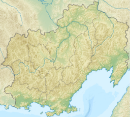 Kolyma Reservoir | |
| Location | Upper Kolyma Highlands Magadan Oblast |
| Coordinates | 62°02′43″N 150°03′11″E |
| Type | Hydroelectric reservoir |
| Primary inflows | Kolyma, Tenka, Kongo |
| Primary outflows | Kolyma |
| Catchment area | 61,500 km2 (23,700 sq mi) |
| Basin countries | Russia |
| Max. length | 148 km (92 mi) |
| Max. width | 6 km (3.7 mi) |
| Surface area | 441 km2 (170 sq mi) |
| Max. depth | 120 m (390 ft) |
| Water volume | 14.56 km3 (3.49 cu mi) |
| Surface elevation | 387 m (1,270 ft) |
| Islands | None |
| Settlements | Sinegorye |
Description
The Kolyma Reservoir is in the Upper Kolyma Highlands. The town of Sinegorye, Yagodninsky District, is located downstream from the dam. The total length of the reservoir is 148 km (92 mi) and the width at its widest point is 6 km (3.7 mi). The height of the water's edge is 387 m (1,270 ft) above sea level. Besides the Kolyma, rivers Tenka and Kongo flow into the reservoir.[2][3]
After filling the reservoir 40,840 ha (100,900 acres) of farmland were flooded, as well as several workers' settlements, including Sibik-Tyllah, Vetreny, Yasnaya Polyana, Tyoply, Yubileiny and Kongo.[4][5]
An Old Stone Age archaeological site located by the mouth of the Kongo was also flooded by the waters of the Kolyma reservoir. It belonged to the Paleolithic Siberdikov culture of the upper Kolyma river. On it were found stone cutters, knives, arrowheads and pick-shaped tools belonging to a human group engaged in hunting wild horses and reindeer.[6]
See also
- Kolyma Hydroelectric Station
- Ust-Srednekan Hydroelectric Plant
References
- Словарь названий гидрографических объектов России и других стран — членов СНГ / под ред. Г. И. Донидзе. — М.: Картгеоцентр — Геодезиздат, 1999. — p. 188 ISBN 5-86066-017-0
- Google Earth
- Колымское водохранилище - Water of Russia
- Kolyma reservoir - voda.mnr.gov.ru Rosvodresursy (2017)
- Грибанова И. В. (2013). Тенька. Виток Спирали (700 экз ed.). Магадан: Охотник. p. 225. ISBN 978-5-9904382-2-4.
- Орехов А. А. (1988). Первобытнообщинный строй на территории Колымы и Чукотки : Пособие для учителей истории. Магадан: Кн. изд-во. p. 10.
External links
 Media related to Kolyma hydroelectric power plant at Wikimedia Commons
На других языках
[de] Kolyma-Stausee
Der Kolyma-Stausee ist eine Talsperre an der Kolyma in Ostsibirien.- [en] Kolyma Reservoir
[ru] Колымское водохранилище
Колы́мское водохрани́лище[1] — искусственный водоём в Магаданской области России, образованный на реке Колыма в результате строительства Колымской ГЭС[2]. Спроектировано институтом Ленгидропроект.Другой контент может иметь иную лицензию. Перед использованием материалов сайта WikiSort.org внимательно изучите правила лицензирования конкретных элементов наполнения сайта.
WikiSort.org - проект по пересортировке и дополнению контента Википедии