geo.wikisort.org - Reservoir
Kaplong Hydroelectric Project (Kalpong Dam) is the largest dam of the Andaman & Nicobar Islands. Built across the Kalpong River at Nabagram Diglipur in the North and Middle Andaman district the dam was completed in 2001 and commissioned on 1 September 2001 by Shri M. Kannappan the Minister of State for Non-Conventional Energy Sources. The dam was executed by NHPC and run by Electricity Department[2] of Andaman & Nicobar Administration was commissioned 15 months ahead of schedule.[3]
This article uses bare URLs, which are uninformative and vulnerable to link rot. (September 2022) |
This article needs additional citations for verification. (April 2018) |
| Kalpong Dam | |
|---|---|
 | |
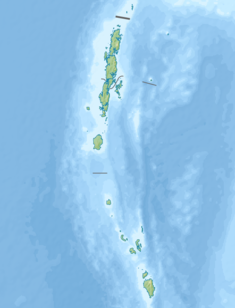 Location of Kalpong Dam in Andaman and Nicobar Islands | |
| Official name | Kalpong Hydro Electric Project[1] |
| Country | India |
| Location | Andaman and Nicobar Islands |
| Coordinates | 13°09′16″N 92°58′02″E |
| Status | Operational |
| Opening date | 2001 |
| Owner(s) | NHPC |
| Dam and spillways | |
| Type of dam | Left Fork- Concrete Gravity dam, Right Fork - Rock-Fill |
| Impounds | Kalpong River |
| Height | Concrete Dam 34 m (112 ft), Rock-fill Dam 27 m (89 ft) |
| Length | Concrete Dam 138 m (453 ft), Rock-fill Dam 146 m (479 ft) |
| Spillway type | Gate controlled |
| Spillway capacity | 4.05 Cumec |
| Reservoir | |
| Total capacity | 0.02 km3 (16,000 acre⋅ft) |
| Power Station | |
| Commission date | 2001 |
| Type | Pumped-storage |
| Turbines | 3 x Francis turbines |
| Installed capacity | 5.25 MW (7,040 hp) |
| Annual generation | 14.83 MU |
| Website https://vidyut.andaman.gov.in/ | |
It is a Rock-Fill and Concrete Gravity dam with an storage capacity of 15,270,000 m3 (12,380 acre·ft) and having a reservoir area of 1,.84 Km2 (455 acres). The length of Concrete dam on left fork is 138 m (452.7 ft) and the height is 34 m (103 ft) while length of Rockfill Dam on right fork is 146 m (479 ft) and the height is 27 m (88.5 ft).
Kalpong Hydroelectric Project has an installed capacity of 5.25 MW of electricity. It is the only hydro-electric project in the Andaman and Nicobar Islands. The project is expected to generate 14.83 million units of electricity annually for the people of Andaman and Nicobar Islands notably for the residence of Diglipur and its nearby towns. The production cost of electricity from the Kalpong project is merely Rs. 1.89 per unit at the time of commissioning.
Technical Features
| Particulars | Details |
|---|---|
| Catchment Area | Left Fork 10.7 km2
Right Fork 4.56 Km2 |
| Maximum Water Level (MWL) | EL-209.40 m |
| Full Reservoir Level (FRL) | EL-206.80 m |
| Maximum Draw Down Level (MDDL) | EL-192.00 m |
| Capacity at FRL | EL-1527 Ha.m (0.02 Km3) |
| Length of Link Channel | 300.00 m |
| Bed Level of Channel | EL-196.oo m |
| Intake Approach Channel | 257.00 m |
| Intake Tunnel | 2m x 2m D-Shaped |
| Length of Tunnel | 127.00 m Dykes 3 Nos |
| Diameter of Main Penstock | 1200 mm |
| Length of Main Penstock | 650.00 m |
| Design Discharge | 4.05 Cumecs |
| Power House Dimensions | 31.5m x 13.5m x 10.0m |
| Installed Capacity | 3 x Francis Turbine 1750 KW each |
| Firm Power | 1430 KW |
| NRLD No. | AN15HH0002[4] |
Gallery
 Generator House
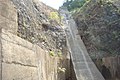 Penstock


See also
- List of dams and reservoirs in Andaman and Nicobar Islands
- Kalpong River
References
- http://india-wris.nrsc.gov.in/wrpinfo/index.php?title=Kalpong_Hydroelectric_Project_JH01586 [dead link]
- https://vidyut.andaman.gov.in/
- http://www.coalpost.in/hydro-power/list-of-dams-in-india/dams-hydel-projects-andaman-nicobar/kalpong-dam-hydel-project/
- "Kalpong(NHPC) Dam D06042 -". Archived from the original on 6 April 2018. Retrieved 6 April 2018.
This article about a dam, floodgate or canal in India is a stub. You can help Wikipedia by expanding it. |
Другой контент может иметь иную лицензию. Перед использованием материалов сайта WikiSort.org внимательно изучите правила лицензирования конкретных элементов наполнения сайта.
WikiSort.org - проект по пересортировке и дополнению контента Википедии