geo.wikisort.org - Reservoir
John Martin Reservoir is a reservoir on the Arkansas River in southeastern Colorado.[6] Built and managed by the U.S. Army Corps of Engineers, it is used for flood control, irrigation, and recreation.[5] John Martin Reservoir State Park lies on its shore.[7]
| John Martin Reservoir | |
|---|---|
 View of the reservoir looking west from John Martin Dam (2014) | |
 John Martin Reservoir  John Martin Reservoir | |
| Location | Bent County, Colorado |
| Coordinates | 38°04′23″N 103°01′41″W |
| Type | Reservoir |
| Primary inflows | Arkansas River |
| Primary outflows | Arkansas River |
| Catchment area | 18,915 sq mi (48,990 km2) |
| Basin countries | United States |
| Managing agency | U.S. Army Corps of Engineers |
| Built | 1939 |
| First flooded | January 1943 |
| Surface area | 11,658 acres (47.18 km2)[1] |
| Average depth | 5–10 ft (1.5–3.0 m) |
| Max. depth | 60 ft (18 m)[2] |
| Water volume | Full: 340,771 acre⋅ft (420,335,000 m3)[1] Current (Dec. 2015): 224,000 acre⋅ft (276,000,000 m3)[3] |
| Shore length1 | 22 mi (35 km)[4] |
| Surface elevation | Full: 3,852 ft (1,174 m)[5] Current (Dec. 2015): 3,840 ft (1,170 m)[3] |
| Settlements | Caddoa, Hasty, Las Animas |
| 1 Shore length is not a well-defined measure. | |
History
In the 1930s, U.S. Representative from Colorado John Martin successfully advocated for legislation in the U.S. Congress approving the building of a reservoir on the Arkansas River for the purposes of flood control. Signed into law in 1939 by President Roosevelt, the legislation assigned the task of construction to the U.S. Army Corps of Engineers. The effort required the U.S. government to buy more than 20,000 acres (81 km2) of land and relocate 21 miles (34 km) of Santa Fe Railway track.[7]
Construction of Caddoa Dam and Reservoir started in the fall of 1939.[5] Rep. Martin died that year, and, in June 1940, both the dam and reservoir were renamed in his honor.[7] Storage of water in the reservoir began in January 1943.[5] The diversion of resources to fighting World War II caused delays in the project until 1946.[7] The dam was finally completed in October 1948.[5]
In 1935 the U.S. Army Corps established the Tucumcari District to develop the Conchas Project in Eastern New Mexico. At the conclusion of the construction of the Conchas Project the focus of the District moved to Caddoa, Colorado to construct the Caddoa Reservoir Project. The District staff relocated to Caddoa Colorado in December 4, 1939. At this time the District name was changed to the Caddoa District. In 1942 with the advent of World War Two the District made its final move to Albuquerque, New Mexico and was renamed the Albuquerque District which has remained the same since. At this time the focus of the district switched from Civil Works to Wartime activities which included work to facilitate the development of Los Alamos Laboratory and their development of atomic energy and its application to weapons.[8]
In December 1948, the state governments of Colorado and Kansas signed the Arkansas River Compact, an agreement governing the two states' access to the river's water, including John Martin Reservoir.[9] In 1980, the states developed a plan allocating 60% of the reservoir's water to Colorado and 40% to Kansas. Adherence to the Compact has been a recurrent source of controversy between the two states, serving as a primary factor in the decades-long water conflict litigation Kansas v. Colorado.[10]
Geography

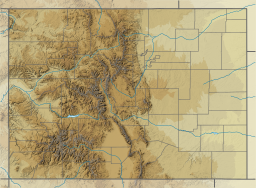
John Martin Reservoir is located at 38°04′23″N 103°01′41″W (38.0730328, -103.0279951) at an elevation of 3,852 feet (1,174 m).[6] It lies in southeastern Colorado in the Colorado Piedmont region of the Great Plains.[11][12] The entirety of the reservoir lies within Bent County.[11]
The reservoir is impounded at its eastern end by John Martin Dam. The dam is located at 38°04′00″N 102°56′14″W (38.0666741, -102.9371452) at an elevation of 3,852 feet (1,174 m).[13] The Arkansas River is both the reservoir's primary inflow from the west and outflow to the east. Smaller tributaries include Rule Creek, which flows into the reservoir from the south, and Gageby Creek, which flows in from the north.[11]
U.S. Route 50 runs generally east-west north of the reservoir.[11] Colorado State Highway 183 runs north-south between U.S. 50 and Fort Lyon immediately northwest of the reservoir.[14] A BNSF Railway line runs generally east-west along the reservoir's southern shoreline, crossing the southern arm fed by Rule Creek.[11]
The city of Las Animas lies on the south bank of the Arkansas River 4 miles (6.4 km) west of the reservoir. Hasty, an unincorporated community, is located on U.S. 50 roughly 2 miles (3.2 km) north of the reservoir's eastern end.[11][14] Caddoa, also unincorporated, lies immediately east of the dam.[11]
Hydrography
The surface area, surface elevation, and water volume of the reservoir fluctuate based on inflow and local climatic conditions.[3] In terms of capacity, the Corps of Engineers vertically divides the reservoir into a set of pools based on volume and water level, and the reservoir is considered full when filled to the capacity of its recreation and conservation pool. When full, John Martin Reservoir has a surface area of 11,658 acres (47.18 km2), a surface elevation of 3,852 feet (1,174 m), and a volume of 340,771 acre⋅ft (420,335,000 m3). When filled to maximum capacity, it has a surface area of 20,516 acres (83.03 km2), a surface elevation of 3,880 feet (1,180 m), and a volume of 788,104 acre⋅ft (972,112,000 m3).[1]
The streambed underlying the reservoir has an elevation of 3,765 feet (1,148 m). Since the reservoir's initial flooding, sedimentation has gradually accumulated on the reservoir bottom thus raising its elevation.[1]
Infrastructure

John Martin Dam is an earth-fill embankment dam that stands 118 feet (36 m) tall and 2.6 miles (4.2 km) long.[5][7] A portion of the dam's midsection is a concrete spillway controlled by 16 radial gates which empty into the Arkansas River.[5][15] When the reservoir is filled to its maximum capacity, the spillway has a discharge capacity of 660,000 cubic feet per second (19,000 m3/s). When the reservoir is filled to the top of its flood control pool, the river outlet has a capacity of 16,300 cubic feet per second (460 m3/s).[3]
Management
The Albuquerque District of the U.S. Army Corps of Engineers manages both the dam and the reservoir for the purposes of flood control and irrigation.[16] Colorado Parks and Wildlife manages the reservoir surface and all recreational activities at the reservoir including John Martin Reservoir State Park.[17] The agency also oversees 19,471 acres (78.80 km2) adjoining the park as the John Martin Reservoir State Wildlife Area.[18]
Parks and recreation
John Martin Reservoir State Park is located on the north shore of the reservoir's eastern end, and it extends east to include the area immediately below the dam. The park hosts boat ramps, camping facilities, a hiking trail, and wetland habitats. Below the dam is a small reservoir named Lake Hasty which includes a swimming beach.[17]
John Martin Reservoir is open for sport fishing. Hunting is forbidden in the state park but permitted in the neighboring wildlife area.[17]
Points of interest
A preserved 0.5-mile (0.80 km) section of the Santa Fe Trail lies north of the reservoir, commemorated by a historical marker placed by the Daughters of the American Revolution.[19]
Fort Lyon National Cemetery is located immediately west of the reservoir.[19]
Wildlife
John Martin Reservoir is a productive warm water fishery, providing species including saugeye, wiper, white bass, crappie, and catfish. These fish are stocked as needed.[20]
With 373 documented species of birds in Bent County, John Martin Reservoir is considered a premier birding area.[17] Additionally, during winter months, bald eagles can be found throughout the area. During the winter of 2001-2002, 126 eagles were documented.[21]
Other wildlife common in the area include deer, prairie dogs, rabbits, raccoons, and squirrels.[17]
See also
- List of largest reservoirs of Colorado
References
- "John Martin Reservoir". U.S. Army Corps of Engineers. Retrieved 2015-12-30.[permanent dead link]
- Colorado Lakes and Reservoirs: Fishing and Boating Guide. Adler Publishing. 2008-07-15. p. 86.
- "USGS 07130000 John Martin Reservoir at Caddoa, CO". U.S. Geological Survey. Retrieved 2015-12-30.
- United States Army Corps of Engineers (2012). "US Army Corps of Engineers — Value to the Nation". Retrieved 2015-01-04.
- United States Geological Survey - Water Resources of Colorado (2004-04-28). "Arkansas River Basin". Retrieved 2015-12-30.
- "John Martin Reservoir". Geographic Names Information System. United States Geological Survey. Retrieved 2015-12-29.
- Santa Fe Trail Co. "John Martin Reservoir State Park on the Santa Fe Trail". Retrieved 2015-01-04.
- "The History of the Albuquerque District". U.S. Army Corp of Engineers. Retrieved 17 September 2021.
- "Arkansas River Compact". Arkansas River Compact Administration. Retrieved 2015-12-31.
- "Fact Sheet - Kansas-Colorado Arkansas River Compact" (PDF). Kansas Department of Agriculture. Retrieved 2015-12-31.
- "Colorado [Map]" (PDF). Colorado Department of Transportation. Retrieved 2015-12-29.
- "Physiographic Provinces of Colorado". Colorado Geological Survey. Retrieved 2015-12-29.
- "John Martin Reservoir Dam". Geographic Names Information System. United States Geological Survey. Retrieved 2015-12-29.
- "Bent County [Map]" (PDF). Colorado Department of Transportation. 2015-09-14. Retrieved 2015-12-29.
- "Biennial Report of the State Engineer to the Governor of Colorado for the Years 1943-1944". Colorado Department of Water Resources. 1946. Retrieved 2015-12-31.
- "Welcome to John Martin Dam & Reservoir". U.S. Army Corps of Engineers. Retrieved 2015-12-31.
- "John Martin Reservoir State Park" (PDF). Colorado Parks and Wildlife. Retrieved 2015-12-31.
- "John Martin Reservoir SWA". Colorado Parks and Wildlife. Retrieved 2015-12-31.
- "Recreation". U.S. Army Corps of Engineers. Retrieved 2016-01-05.
- Colorado Parks and Wildlife (2013). "John Martin Reservoir: Fish Survey and Management Information" (PDF). Archived from the original (PDF) on 2015-01-05. Retrieved 2015-01-04.
- Colorado Parks and Wildlife. "Bald Eagles at John Martin Reservoir State Park" (PDF). Retrieved 2015-01-04.
External links
- John Martin Reservoir, U.S. Army Corps of Engineers
- John Martin Reservoir State Park, Colorado Parks & Wildlife
- John Martin Reservoir State Wildlife Area, Colorado Parks & Wildlife
Authority control | |
|---|---|
| General |
|
| National libraries | |
| Other | |
Другой контент может иметь иную лицензию. Перед использованием материалов сайта WikiSort.org внимательно изучите правила лицензирования конкретных элементов наполнения сайта.
WikiSort.org - проект по пересортировке и дополнению контента Википедии