geo.wikisort.org - Reservoir
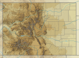
Independence Lake is an alpine lake in Pitkin County, Colorado, United States, located high in the Sawatch Range in the Hunter-Fryingpan Wilderness of White River National Forest. It is the source of the Roaring Fork River and is located south and over a pass from Lost Man Lake and north of Twining Peak. The lake is accessible via a trail from State Highway 82 west of Independence Pass.[1][2]
| Independence Lake | |
|---|---|
 Independence Lake and Twining Peak | |
 Independence Lake  Independence Lake | |
| Location | Pitkin County, Colorado, United States |
| Coordinates | 39.143882°N 106.567634°W |
| Lake type | Glacial |
| Primary outflows | Roaring Fork River |
| Basin countries | United States |
| Max. length | 0.23 mi (0.37 km) |
| Max. width | 0.09 mi (0.14 km) |
| Surface elevation | 12,497 ft (3,809 m) |
References
- "Independence Lake". Geographic Names Information System. United States Geological Survey, United States Department of the Interior. Retrieved August 21, 2012.
- Aspen/Independence Pass 127 (Map) (2005 ed.). Trails Illustrated. National Geographic Society. 1984.
Текст в блоке "Читать" взят с сайта "Википедия" и доступен по лицензии Creative Commons Attribution-ShareAlike; в отдельных случаях могут действовать дополнительные условия.
Другой контент может иметь иную лицензию. Перед использованием материалов сайта WikiSort.org внимательно изучите правила лицензирования конкретных элементов наполнения сайта.
Другой контент может иметь иную лицензию. Перед использованием материалов сайта WikiSort.org внимательно изучите правила лицензирования конкретных элементов наполнения сайта.
2019-2026
WikiSort.org - проект по пересортировке и дополнению контента Википедии
WikiSort.org - проект по пересортировке и дополнению контента Википедии