geo.wikisort.org - Reservoir
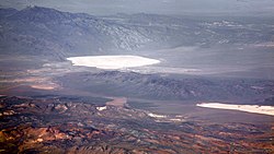
Groom Lake is a dry lake,[1] also described as a salt flat,[2] in Nevada. It is used for runways of the Nellis Bombing Range Test Site airport (KXTA).[3] Part of the Area 51 USAF installation, it lies at an elevation of 4,409 ft (1,344 m)[4] and is approximately 3.7 miles (6.0 km) from north to south and 3 miles (4.8 km) from east to west at its widest point, and is approximately 11.3 miles in circumference.[5] Located within the namesake Groom Lake Valley portion of the Tonopah Basin, the lake is 25 mi (40 km) south of Rachel, Nevada.[5]

The nearest publicly accessible vantage point is Tikaboo Peak, 26 miles to the east. There were two closer vantage points, dubbed "Freedom Ridge" and "White Sides", but they were closed to public access in 1995 to prevent people from taking pictures of the installation.[6]
History
Lead and silver were discovered in the southern part of the Groom Range in 1864,[7] and the English Groome Lead Mines Limited company financed the Conception Mines in the 1870s, giving the district its name (nearby mines included Maria, Willow and White Lake). The mining claims in Groom were acquired by J. B. Osborne and partners and patented in 1876, and Osborne's son acquired the interests in the 1890s.[8] The claims were proved in 1916 when two companies began working their mines; that work continued until 1918, and resuming after World War II until the early 1950s.[8]
In popular culture
In the Call Of Duty: Black Ops franchise's Zombies mode, Groom Lake appears repeatedly as a test site for the American government's experiments with lunar teleportation.
References
- Annie Jacobsen (May 17, 2011). Area 51: An Uncensored History of America's Top Secret Military Base. Little, Brown. p. 7. ISBN 978-0-316-19385-6.
- Leiby, Richard (August 16, 2013). "Government officially acknowledges existence of Area 51, but not the UFOs". Washington Post. Retrieved December 25, 2017.
- Marsh, Alton K. (January 10, 2008). "Don't Ask, Don't Tell: Area 51 Gets Airport Identifier". AOPA. Maryland. Retrieved March 6, 2019.
Weinberger, Sharon (January 18, 2018). "Area 51's New Name: 'Homey Airport'". Wired. New York. Retrieved March 6, 2019. - "Groom Lake (GNIS code 840824)". Geographic Names Information System. United States Geological Survey, United States Department of the Interior. Retrieved January 11, 2015.
- DREAMLAND: Fifty Years of Secret Flight Testing in Nevada By Peter W. Merlin
- "Freedom Ridge and Roadblock Canyon". Dreamland Resort.
- Mineral resources of the Pahranagat Range 30' by 60' quadrangle Archived April 15, 2012, at the Wayback Machine, Joseph V. Tingley, Nevada Bureau of Mines and Geology, University of Nevada, Reno, 1989, retrieved June 11, 2010
- "A Guide to the Records of The Groom Mining District Collection No. 99-19". University of Nevada, Reno. Retrieved September 21, 2016.
На других языках
- [en] Groom Lake (salt flat)
[es] Lago Groom
Lago Groom (en inglés: Groom Lake) es un salar ubicado en Nevada, Estados Unidos. Se ha hecho muy conocido debido a la presencia del Área 51, las palabras Groom Lake y Área 51 se utilizan con frecuencia como sinónimos. El Área 51 está situada justo al sur del salar, pero el lecho seco del lago es también utilizado por la Fuerza Aérea, con varias pistas de aterrizaje que han sido construidas sobre el mismo. El lago se encuentra a unos 1.344 m de altitud y tiene una longitud de 6 km de norte a sur y 4,8 km de este a oeste en su punto más ancho. Ubicado en el interior del valle de Groom Lake y parte de la Cuenca del Valle de Tonopah, el lago se encuentra al noreste de Papoose Lake y a 40 km al sur de Rachel, Nevada.[fr] Lac Groom
Le lac Groom est un salar situé dans l'état du Nevada aux États-Unis[1]. La zone 51 est située à proximité du lac Groom.[it] Lago Groom
Il lago Groom (Groom Lake in lingua inglese) è il letto di un antico lago salato situato a 40 km a sud della cittadina di Rachel, nel Nevada, noto poiché sulla sponda sud sorge la famosa Area 51, della quale è sovente stato sinonimo. Il letto asciutto del lago è utilizzato dall'USAF, che vi ha costruito alcune piste di atterraggio, lunghe diverse miglia. Il lago misura approssimativamente 6 km dall'estremità nord a quella sud e 4,8 km dall'estremità est a quella ovest.[ru] Грум-Лейк
Грум-Лейк (англ. Groom Lake) — солончак в США, на юге штата Невада. На нём располагаются взлётно-посадочные полосы тестовой площадки бомбардировочного полигона авиабазы Неллис (англ. Nellis Bombing Range Test Site airport), более известной как Зона 51. Грум-Лейк находится в 1344 м над уровнем моря[1][2], имеет длину 6 км с севера на юг и 4,8 км с востока на запад в крайних точках[3]. Расположенное в одноимённой долине Грум-Лейк-Вэлли (англ. Groom Lake Valley), частично в бассейне Тонопа[en], озеро находится к северо-востоку от комплекса Сектор 4[en] на Папуз-Лейк и в 40 километрах к югу от города Рейчел[en][3].Другой контент может иметь иную лицензию. Перед использованием материалов сайта WikiSort.org внимательно изучите правила лицензирования конкретных элементов наполнения сайта.
WikiSort.org - проект по пересортировке и дополнению контента Википедии