geo.wikisort.org - Reservoir
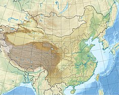
The Gezhouba Dam or Gezhouba Water Control Project (Chinese: 长江葛洲坝水利枢纽工程) on the Yangtze River is located in the western suburbs of Yichang, in central China's Hubei province. One of the largest run-of-the-river dams,[1] it sits several kilometers upstream from downtown Yichang, just downstream of the fall of the Huangbo River into the Yangtze. Construction started on December 30, 1970 and ended on December 10, 1988. The dam has a total installed electrical capacity of 2,715 MW.[2]
| Gezhouba Dam | |
|---|---|
 The Gezhouba Dam site | |
| Location | Yichang, China |
| Coordinates | 30°44′23″N 111°16′20″E |
| Dam and spillways | |
| Type of dam | Concrete gravity, run-of-the-river |
| Impounds | Yangtze River |
| Height | 47 m (154 ft) |
| Length | 2,595 m (8,514 ft) |
| Reservoir | |
| Total capacity | 1.58 km3 (1,280,000 acre⋅ft) |
| Power Station | |
| Operator(s) | China Yangtze Power |
| Type | Run-of-the-river |
| Installed capacity | 2,715 MW |
| Annual generation | 14,100 GWh |
| Gezhouba Dam | |||||||
|---|---|---|---|---|---|---|---|
| Traditional Chinese | 長江葛洲壩水利樞紐工程 | ||||||
| Simplified Chinese | 长江葛洲坝水利枢纽工程 | ||||||
| Literal meaning | Yangtze River Gezhouba Water Control Project | ||||||
| |||||||
After rushing out of Nanjin Pass (南津关, "South Ford Pass"), the Yangtze River slows down and widens from 300 metres (980 ft) to about 2,200 metres (7,200 ft) at the dam site. Two small islands, Gezhouba and Xiba, divided the river into three channels. There the Gezhouba Project was built.
The facility boasts a generating capacity of 2.71 GW along with three ship locks, two power stations that generate 14,100 GWh of electricity annually. It has 27 gates of spillway, and a non-flowing Dam on both banks. The dam is 2,595 metres (8,514 ft) long with a maximum height of 47 metres (154 ft). The reservoir has a total volume of 1.58 cubic kilometres (1,280,000 acre⋅ft).
The navigation lock No.2 on the third channel was, when built, among the 100 largest in the world. The lock chamber is 280 metres (920 ft) long and 34 metres (112 ft) wide, with a minimum draft of 5 metres (16 ft) at the sill. It provides passage for 10,000 ton ships.
The construction of the Gezhouba Dam, and others on the Yangtze, is considered by scientists to be one of the main causes of the decline and extinction of the Chinese paddlefish.[3][4]
See also
References
- Gezhouba, China, Power Technology, Nov 2021, retrieved 2022-09-12
- "Gezhouba Dam Project". Green Travel. Archived from the original on 4 April 2013. Retrieved 23 August 2011.
- "14 Animals Declared Extinct - Chinese Paddlefish". Christian Science Monitor. Retrieved 20 January 2017.
- "THE CHINESE PADDLEFISH, ONE OF WORLD'S LARGEST FISH, HAS GONE EXTINCT". National Geographic. Retrieved 7 May 2020.
External links
- Pictures of Gezhouba Dam & Gezhouba Shiplock
- Hubei: Gezhouba Water Control Project
- China News: Gezhouba Dam
На других языках
[de] Gezhouba-Talsperre
Die Gezhouba-Talsperre (chinesisch 长江葛洲坝水利枢纽工程, englisch Gezhouba Dam bzw. Gezhouba Water Control Project) ist eine Talsperre am Jangtsekiang mit einem Wasserkraftwerk und drei Schleusen. Sie wurde bei Yichang in der Provinz Hubei in Zentralchina erbaut und liegt 38 km unterhalb der Drei-Schluchten-Talsperre.- [en] Gezhouba Dam
[ru] Гэчжоуба
Гэчжоуская плотина на Янцзы по контролю за водой (кит. упр. 长江葛洲坝水利枢纽工程, пиньинь chángjiāng gězhōubà shuǐlì shūniǔ gōngchéng), или Гэчжоуба, находится в западной части городского округа Ичан провинции Хубэй. Плотина находится в нескольких километрах вверх по течению от центра Ичан, ниже по течению от впадения реки Хуанбо в Янцзы.Другой контент может иметь иную лицензию. Перед использованием материалов сайта WikiSort.org внимательно изучите правила лицензирования конкретных элементов наполнения сайта.
WikiSort.org - проект по пересортировке и дополнению контента Википедии
