geo.wikisort.org - Reservoir
Gaslyn Lake is a 161-acre (65 ha) lake located in Burnett County, Wisconsin.[2] It has a maximum depth of 12 feet. Visitors have access to the lake from a public boat landing. Fish include panfish, largemouth bass and northern pike.[3]
| Gaslyn Lake | |
|---|---|
  Gaslyn Lake 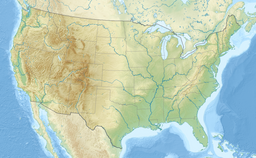 Gaslyn Lake | |
| Location | Burnett County, Wisconsin |
| Coordinates | 45.900°N 92.117°W |
| Type | Drainage Lake |
| Surface area | 161 acres (65 ha) |
| Average depth | 6 feet (1.8 m) |
| Max. depth | 12 feet (3.7 m) |
| Water volume | 989.2 acre-feet (1,220,200 m3)[1] |
| Shore length1 | 989.2 miles (1,592.0 km) |
| Settlements | Shell Lake |
| 1 Shore length is not a well-defined measure. | |
References
- "Lake Survey Map" (PDF). Wisconsin DNR. Retrieved 30 August 2022.
- "Gaslyn Lake". Geographic Names Information System. United States Geological Survey, United States Department of the Interior. Retrieved September 23, 2021.
- "Gaslyn Lake". dnr.wi.gov. Retrieved 2021-09-16.
 | This article about a lake is a stub. You can help Wikipedia by expanding it. |
Текст в блоке "Читать" взят с сайта "Википедия" и доступен по лицензии Creative Commons Attribution-ShareAlike; в отдельных случаях могут действовать дополнительные условия.
Другой контент может иметь иную лицензию. Перед использованием материалов сайта WikiSort.org внимательно изучите правила лицензирования конкретных элементов наполнения сайта.
Другой контент может иметь иную лицензию. Перед использованием материалов сайта WikiSort.org внимательно изучите правила лицензирования конкретных элементов наполнения сайта.
2019-2026
WikiSort.org - проект по пересортировке и дополнению контента Википедии
WikiSort.org - проект по пересортировке и дополнению контента Википедии