geo.wikisort.org - Reservoir
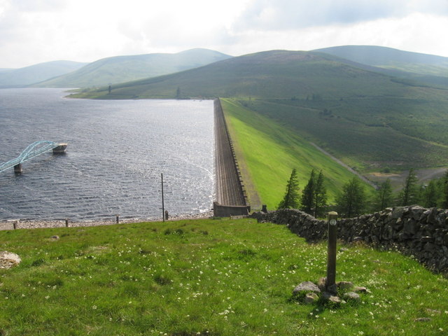
Daer Reservoir is a man-made waterbody created by the damming of the Daer Water, a tributary of the River Clyde in the Southern Uplands of Scotland. It lies within the Lowther Hills in South Lanarkshire. A minor public road leaving the A702 follows the Daer Water south to the dam and then continues along the western margin of the reservoir as far as Kirkhope.[1] The reservoir was officially opened by Queen Elizabeth II in 1956 to supply water to the Scottish Central Belt.[2]
| Daer Reservoir | |
|---|---|
 Daer Reservoir | |
| Location | South Lanarkshire, Scotland |
| Coordinates | 55.353°N 3.617°W |
| Type | reservoir |
Recreation
Season tickets for fishing in the reservoir for brown trout are available from Kilbryde Angling Club.[3] The Southern Upland Way passes just to the north of the dam and affords views over the reservoir for the walker. [4]
References
- Ordnance Survey 1:25,000 scale Explorer map sheet no 329 Lowther Hills, Sanquhar & Leadhills
- "Daer Reservoir". Biggararchaeology.org.uk. Archived from the original on 14 July 2015. Retrieved 13 July 2015.
- "Fishing in Strathclyde - Scotland". Archived from the original on 19 August 2011. Retrieved 14 September 2011.
- "Map 56 Daer Reservoir South Getting outdoors - South Lanarkshire Council". Southlanarkshire.gov.uk. 19 September 2014. Retrieved 13 July 2015.
Текст в блоке "Читать" взят с сайта "Википедия" и доступен по лицензии Creative Commons Attribution-ShareAlike; в отдельных случаях могут действовать дополнительные условия.
Другой контент может иметь иную лицензию. Перед использованием материалов сайта WikiSort.org внимательно изучите правила лицензирования конкретных элементов наполнения сайта.
Другой контент может иметь иную лицензию. Перед использованием материалов сайта WikiSort.org внимательно изучите правила лицензирования конкретных элементов наполнения сайта.
2019-2025
WikiSort.org - проект по пересортировке и дополнению контента Википедии
WikiSort.org - проект по пересортировке и дополнению контента Википедии