geo.wikisort.org - Reservoir
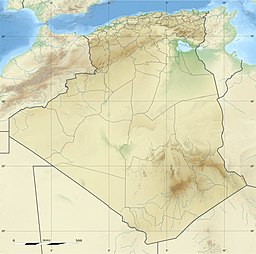
Chott Ech Chergui (Arabic: شط الشرقي) is a large endorheic salt lake in Saïda Province, northwestern Algeria.[2] It is located at 34.35°N 0.5°E in the level terrain of the Hautes Plaines region between the Tell Atlas and the Saharan Atlas and is one of the largest lakes in Algeria.
| Chott Ech Chergui | |
|---|---|
 from space | |
| Coordinates | 34.35°N 0.5°E |
| Type | Endorheic salt lake |
| Native name | شط الشرقي (Arabic) |
| Basin countries | Algeria |
| Max. length | 160 km (99 mi) |
| Max. width | 24 km (15 mi) |
| Surface area | 2,000 km2 (770 sq mi) |
| Surface elevation | 1,027 m (3,369 ft) above sea level |
Ramsar Wetland | |
| Designated | 2 February 2001 |
| Reference no. | 1052[1] |
Ecology
The Chott Ech Chergui has an area of about 2000 km² where water collects during the wet season, forming a number of large shallow salt lakes which become salt flats as they dry. The lake area has a length of about 160 km from ENE to WSW and lies at an average elevation of 1000 m.[3]
Chott Ech Chergui has been designated a Ramsar wetland of international importance. The Ramsar site has an area of 8555 km² and is the natural environment for a number of threatened and vulnerable animal and plant species.[4]
See also
- Geography of Algeria
- Hautes Plaines
References
- "Chott Ech Chergui". Ramsar Sites Information Service. Retrieved 25 April 2018.
- Chott ech Chergui - Wilaya de Saida
- Magdi Masgidi & Shafi Noor Islam, Wetlands Management in Algeria: A Case Study on Chott Ech Chergui.
- Wetlands of International Importance: Algeria, Chott Ech Chergui
External links
- (in English) Ramsar Convention website
- (in French) Direction Générale des Forêts
На других языках
[de] Chott Ech Chergui
Der Chott Ech Chergui (arabisch شط الشرقي, DMG Šaṭṭ aš-Šarqī ‚Östlicher Schott‘, auch Schott Chergui) ist der größte Salzsee im Hochland der Schotts in Algerien.- [en] Chott Ech Chergui
[fr] Chott ech Chergui
Le chott ech Chergui ou Chott Ghergui (arabe : شط الشرقي) est un lac d'eau salé situé dans le nord-ouest de l'Algérie. C'est l'un des plus grands lacs d'Algérie et d'Afrique du Nord.[it] Chott ech Chergui
Lo Chott ech Chergui (in arabo: شط ملغيغ) è un bacino endoreico di acqua salata nel nord ovest dell'Algeria.[ru] Шотт-эш-Шерги
Шотт-эш-Шерги[1][2] или Эш-Шерги[3] (араб. شط الشرقي) — большое бессточное солёное озеро (себхи) на территории вилайетов Сайда, Эль-Баяд, Наама и Тиарет, в северо-западной части Алжира. Озеро расположено на Высоких плато[en], между горными цепями Телль-Атлас и Сахарский Атлас. Одно из крупных озёр Алжира[3][2][4].Другой контент может иметь иную лицензию. Перед использованием материалов сайта WikiSort.org внимательно изучите правила лицензирования конкретных элементов наполнения сайта.
WikiSort.org - проект по пересортировке и дополнению контента Википедии
