geo.wikisort.org - Reservoir
Callville Bay is a waterway on the northwestern side of Lake Mead in the U.S. state of Nevada. It has a marina and camping resort. Situated east of Las Vegas and upstream from Las Vegas Bay,[1] it lies within the Lake Mead National Recreation Area, which was established in 1935. Its name derives from the settlement of Callville which was established in 1865 by Anson Call under a directive led by Brigham Young. Though the settlement was abandoned in 1869,[2] and submerged under Lake Mead when the Colorado River was dammed, Callville Bay retained the name.[3]
History
The bay derives its name from the permanent settlement of Callville, known alternately as Call's Landing, Call's Fort, and Old Callville. The settlement, containing residences, a warehouse, and irrigation systems, was established in December 2, 1864 by Anson Call, James Whitmore, A. M. Cannon, Jacob Hamblin and son,[4] under a directive to Call by Brigham Young. The steamboat port of Callville was used for shipping freight to Salt Lake City.[5] The bay was formed and the settlement was submerged after the Colorado River was dammed to form Lake Mead.[6]
Features

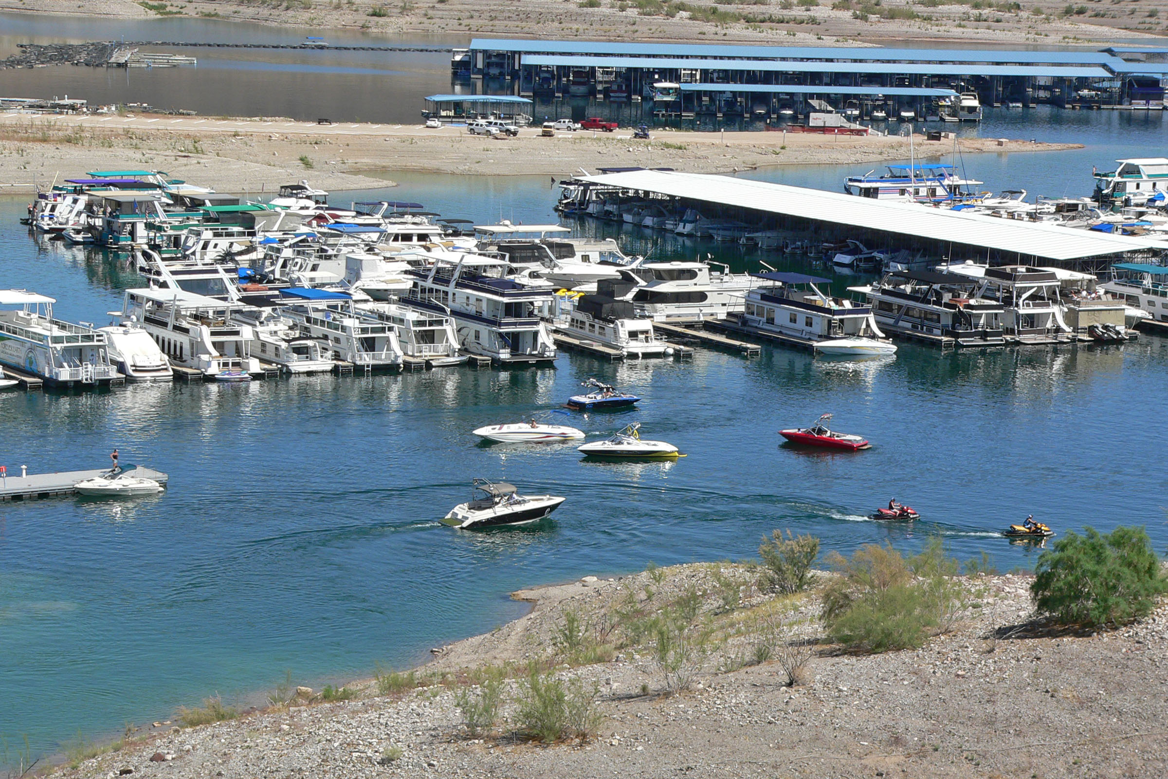
A marina, created after the Hoover Dam was built, is a common launching point for boats onto the lake.[7] It contains 589 boat slips; fishing boats and houseboats are available for rent. Callville also contains a restaurant, lounge, small store, and campground accommodating for about 80 camps.[8]
Geography
Callville settlement was located on the Muddy River in the extreme southeast section of Nevada.[5] The bay is accessed from the land via Callville Bay Road, a turnoff from Callville Bay Junction. The junction is situated 18 miles (29 km) northeast of Henderson while Echo Bay Junction is 24 miles (39 km) to the northeast and Overton is a further 23 miles (37 km).[9] The topography is described as hilly, with no flood hazards near the developed area.[10]
To the north lies Black Mesa, which is characterized by "pink, brown, and red-brown sandstone and siltstone" that lies by the Bitter Spring Valley fault.[11] The nearby "Callville Mesa" is a flat-topped hill capped by volcanic rock.[12] Flora include willows,[8] oleanders, Russian olives, yuccas, palms, and pines trees.[13]
References
- U.S. Geological Survey 1998, p. 16.
- McClintock 1921, p. 281.
- Glass 1983, p. 162.
- McClintock 1921, p. 72.
- "Callville, Nevada P.1". Utah Division of State History. Retrieved 29 September 2013.
- National Park Service. "Callville Bay History". U.S. Department of the Interior. Retrieved 29 September 2013.
- Castor, Joseph V. Tingley, Becky W. Purkey, Ernest M. Duebendorfer, Eugene I. Smith, Jonathan G. Price, and Stephen B. (August 2008). SP016: Geologic tours in the Las Vegas area: Expanded edition with GPS coordinates. NV Bureau of Mines & Geology. p. 67. ISBN 978-1-888035-12-4.
- Sehlinger 2007, pp. 437, 504.
- Preston & Preston 1999, p. 23.
- National Park Service 1985, p. 130.
- Geological Survey Professional Paper. U.S. Government Printing Office. 1984. p. 46. Retrieved 29 September 2013.
- Tingley, Purkey & Duebendorfer 2008, p. 67.
- Smith, Scott (31 May 2011). Moon Nevada. Avalon Travel. p. 171. ISBN 978-1-59880-943-5.
- Bibliography
- Glass, Mary Ellen (1 January 1983). Touring Nevada: A Historic and Scenic Guide. University of Nevada Press. p. 162. ISBN 978-0-87417-074-0.
- McClintock, James H. (1921). Mormon Settlement in Arizona; a Record of Peaceful Conquest of the Desert (Public domain ed.). McClintock.
- National Park Service (1985). Lake Mead National Recreation Area, Mohave County, Arizona, and Clark County, Nevada: Draft general management plan and alternatives. Denver: U.S. Dept. of the Interior, National Park Service.
- Preston, Thomas; Preston, Elizabeth (1 February 1999). Places to Hide: Intermountain West. Discovery Publishing. ISBN 978-0-929760-87-2.
- Sehlinger, Robert W. (19 March 2007). Frommer's Best RV and Tent Campgrounds in the U.S.A. John Wiley & Sons. ISBN 978-0-470-06929-5.
- Tingley, Joseph V.; Purkey, Becky W.; Duebendorfer, Ernest M. (August 2008). SP016: Geologic tours in the Las Vegas area: Expanded edition with GPS coordinates. Eugene I. Smith, Jonathan G. Price, & Stephen B. Castor. NV Bureau of Mines & Geology. ISBN 978-1-888035-12-4.
- U.S. Geological Survey (1998). Circular. Circular 1170. U.S. Department of the Interior.
External links
Другой контент может иметь иную лицензию. Перед использованием материалов сайта WikiSort.org внимательно изучите правила лицензирования конкретных элементов наполнения сайта.
WikiSort.org - проект по пересортировке и дополнению контента Википедии