geo.wikisort.org - Reservoir
National grid reference NR72532231
| Aucha Lochy | |
|---|---|
 | |
 Aucha Lochy | |
| Location | Campbeltown, Scotland |
| Coordinates | 55.4443°N 5.5964°W |
| Type | Reservoir (earth embankment dam) |
| Primary outflows | Auchalochy Burn |
| Basin countries | Scotland, United Kingdom |
| Surface area | 117,400 m2 (1,264,000 sq ft) |
| Water volume | 463,000 m3 (375 acre⋅ft) |
| Surface elevation | 97 m (318 ft) |
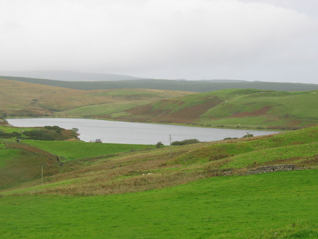
Aucha Lochy is an impounding reservoir, situated 1 km to the north/north east of Campbeltown and is the main source of freshwater for the town.[1] The loch is also fished by Kintyre Angling Club. The earth fill dam was completed in 1905 and has a height of 8.8 metres.
See also
- List of lochs in Scotland
- List of reservoirs and dams in the United Kingdom
Sources
This Argyll and Bute location article is a stub. You can help Wikipedia by expanding it. |
Текст в блоке "Читать" взят с сайта "Википедия" и доступен по лицензии Creative Commons Attribution-ShareAlike; в отдельных случаях могут действовать дополнительные условия.
Другой контент может иметь иную лицензию. Перед использованием материалов сайта WikiSort.org внимательно изучите правила лицензирования конкретных элементов наполнения сайта.
Другой контент может иметь иную лицензию. Перед использованием материалов сайта WikiSort.org внимательно изучите правила лицензирования конкретных элементов наполнения сайта.
2019-2026
WikiSort.org - проект по пересортировке и дополнению контента Википедии
WikiSort.org - проект по пересортировке и дополнению контента Википедии