geo.wikisort.org - Reservoir
Amsoldingersee is small lake adjacent to the town of Amsoldingen, in the Upper Gürbetal.[1][2] It is located near the city of Thun, Switzerland. The lake has a surface area of 38 hectares and a maximum length of 1.1 km and width of 500 m. The maximum depth is 14 m. It is fed by Rotmoos-Bach from the smaller Uebeschisee.
This article may be expanded with text translated from the corresponding article in German. (July 2020) Click [show] for important translation instructions.
|
| Amsoldingersee | |
|---|---|
 | |
 Amsoldingersee  Amsoldingersee  Amsoldingersee | |
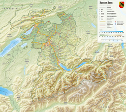
| Location | Canton of Berne |
| Coordinates | 46°43′26″N 7°34′37″E |
| Type | natural |
| Primary inflows | Rotmoos-Bach |
| Primary outflows | Wahlenbach |
| Catchment area | 4.202 km2 (1.622 sq mi) |
| Basin countries | Switzerland |
| Max. length | 1.1 km (0.68 mi) |
| Max. width | 0.5 km (0.31 mi) |
| Surface area | 0.381525 km2 (0.147308 sq mi) |
| Max. depth | 13.9 m (46 ft) |
| Water volume | 2,552,682 m3 (90,147,100 cu ft) |
| Surface elevation | 641 m (2,103 ft) |
| Settlements | Amsoldingen |
 | |
See also
References
- "Amsoldingersee (Amsoldingen, BE)". schweizersee.ch (in Swiss High German). Retrieved 2021-08-08.
- "Beim Amsoldingersee starben Tausende Fische". Thuner Tagblatt (in German). Retrieved 2021-08-08.
This article related to a lake in the canton of Bern is a stub. You can help Wikipedia by expanding it. |
На других языках
[de] Amsoldingersee
Der Amsoldingersee ist ein See im oberen Gürbetal nahe Thun im Kanton Bern, Schweiz.- [en] Amsoldingersee
Текст в блоке "Читать" взят с сайта "Википедия" и доступен по лицензии Creative Commons Attribution-ShareAlike; в отдельных случаях могут действовать дополнительные условия.
Другой контент может иметь иную лицензию. Перед использованием материалов сайта WikiSort.org внимательно изучите правила лицензирования конкретных элементов наполнения сайта.
Другой контент может иметь иную лицензию. Перед использованием материалов сайта WikiSort.org внимательно изучите правила лицензирования конкретных элементов наполнения сайта.
2019-2025
WikiSort.org - проект по пересортировке и дополнению контента Википедии
WikiSort.org - проект по пересортировке и дополнению контента Википедии