geo.wikisort.org - Reservoir
Amisquioumisca Lake is a freshwater body consisting of a major body of water in the Nipukatasi River, on the South Hydrographic Slope of the Broadback River, in the Municipality of Eeyou Istchee Baie-James (municipality), in the administrative region of Nord-du-Québec, in Quebec, in Canada.
| Amisquioumisca Lake | |
|---|---|
 Watershed of Broadback River | |
 Amisquioumisca Lake | |
| Location | Eeyou Istchee Baie-James (municipality) (RCM) |
| Coordinates | 50°27′27″N 76°12′54″W |
| Type | Natural |
| Primary inflows | Some forested creeks |
| Primary outflows | Nipukatasi River |
| Basin countries | Canada |
| Max. length | 14.0 kilometres (8.7 mi) |
| Max. width | 4.7 kilometres (2.9 mi) |
| Surface area | 31.61 kilometres (19.64 mi) |
| Surface elevation | 302 metres (991 ft) |
The forestry is the main economic activity of the sector. Recreational tourism activities come second.
The hydrographic slope of Amisquioumisca Lake is accessible via the James Bay Highway (North-South direction) from Matagami, passing on the west side of the lake.
The surface of Amisquioumisca Lake is usually frozen from early November to mid-May, however, safe ice circulation is generally from mid-November to mid-April.
Geography
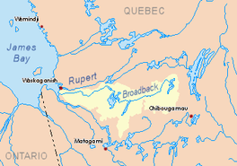
While on the northwest side, the major body of water is Evans Lake.
The Amisquioumisca Lake is fed by several riparian creeks and especially the Nipukatasi River (coming from the North). The current of this river crosses the lake on the south-west.
The Amisquioumisca Lake has a length of 14.0 kilometres (8.7 mi), a width of 4.7 kilometres (2.9 mi), an altitude of 302 kilometres (188 mi) and an area of . Made in length, this lake has 13 islands.
Surrounding areas near the lake include several mountain peaks.
The mouth of the lake is located at:
- 3.4 kilometres (2.1 mi) south-east of the southern part of Rocher Lake (Nipukatasi River);
- 26.0 kilometres (16.2 mi) South of the mouth of Rocher Lake (Nipukatasi River);
- 36.0 kilometres (22.4 mi) south of the mouth of the Nipukatasi River (confluence with the Broadback River);
- 74.1 kilometres (46.0 mi) south-east of the mouth of Evans Lake which is crossed by the Broadback River;
- 197.7 kilometres (122.8 mi) southeast of the mouth of the Broadback River (confluence with Rupert Bay);
- 114.3 kilometres (71.0 mi) north-east of downtown Matagami;
- 157.4 kilometres (97.8 mi) west of downtown Chibougamau.[1]
Toponymy
In the past, the word "Amiskwumiska lake" was used to designate this body of water.
The toponym lac Amisquioumisca was formalized on December 5, 1968 at the Commission de toponymie du Québec, at the creation of this commission.[2]
Notes and references
- River segments measured from the Atlas of Canada (published on the Internet) by the Department of Natural Resources.
- Commission de toponymie du Québec - Bank of Place Names - Toponym: "Amisquioumisca Lake"
See also
- Rupert Bay
- Broadback River, a watercourse
- Evans Lake, a body of water
- Nipukatasi River, a watercourse
- Rocher Lake (Nipukatasi River), a body of water
- Eeyou Istchee James Bay (municipality)
- List of lakes in Canada
На других языках
- [en] Amisquioumisca Lake
[fr] Lac Amisquioumisca
Le lac Amisquioumisca est un plan d'eau douce constituant un plan d'eau majeur de la rivière Nipukatasi, sur le versant hydrographique Sud de la rivière Broadback, dans la municipalité de Eeyou Istchee Baie-James (municipalité), dans la région administrative du Nord-du-Québec, au Québec, au Canada.Другой контент может иметь иную лицензию. Перед использованием материалов сайта WikiSort.org внимательно изучите правила лицензирования конкретных элементов наполнения сайта.
WikiSort.org - проект по пересортировке и дополнению контента Википедии