geo.wikisort.org - Stillgewässer
Der Lake O’Hara ist ein Gebirgssee in den Höhenlagen des Yoho-Nationalparks in der kanadischen Provinz British Columbia. Der See liegt westlich der nordamerikanischen kontinentalen Wasserscheide. Die kanadische Provinz Alberta und der Banff-Nationalpark liegen östlich des Sees. Über den östlich des Sees liegenden Abbot Pass verläuft eine Route zum Lake Louise.
| Lake O’Hara | ||
|---|---|---|
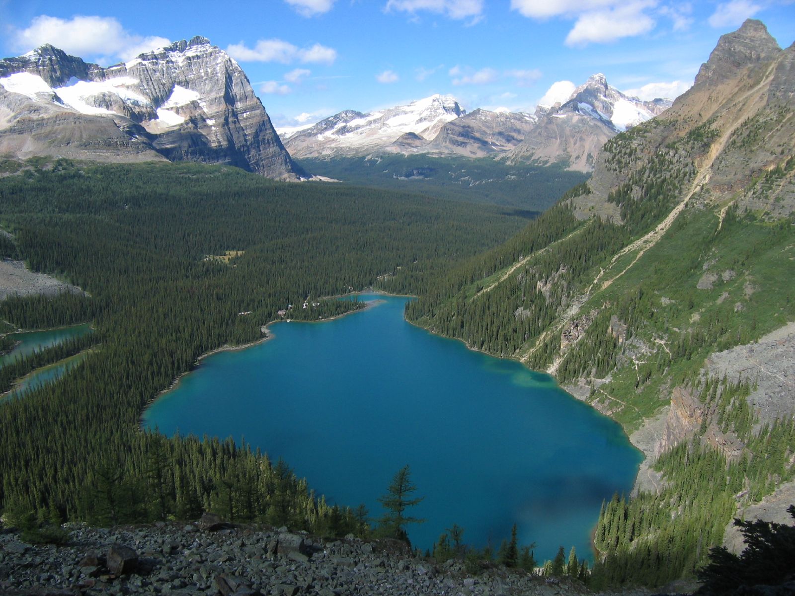 | ||
| Geographische Lage | Yoho-Nationalpark, British Columbia (Kanada) | |
| Abfluss | Cataract Brook → Kicking Horse River → Columbia River | |
| Daten | ||
| Koordinaten | 51° 21′ 21,25″ N, 116° 19′ 49,6″ W | |
| ||
| Höhe über Meeresspiegel | 2115 m | |

Der See ist über eine Busverbindung erreichbar.
Weblinks
- Lake O’Hara. In: BC Geographical Names (englisch).
На других языках
- [de] Lake O’Hara
[en] Lake O'Hara
Lake O'Hara is a lake at an elevation of 2,020 metres (6,630 ft)[1] in the alpine area of Yoho National Park, in the province of British Columbia, on the western side of the Great Divide with the province of Alberta and Banff National Park to the east.[2] The lake and the valley are accessible through a bus service that is run by Parks Canada or by an 11 km hike along a road with an elevation gain of approximately 500m.[3][it] Lago O'Hara
Il lago O'Hara è un piccolo specchio d'acqua tra le Montagne Rocciose situato sul territorio del Parco Nazionale di Yoho. Il nome O'Hara fu attribuito al luogo nel 1894 da Samuel Evans Stokes Allen, alpinista di Filadelfia, in onore del colonnello Robert O'Hara che visitò il lago nel 1889[1].Текст в блоке "Читать" взят с сайта "Википедия" и доступен по лицензии Creative Commons Attribution-ShareAlike; в отдельных случаях могут действовать дополнительные условия.
Другой контент может иметь иную лицензию. Перед использованием материалов сайта WikiSort.org внимательно изучите правила лицензирования конкретных элементов наполнения сайта.
Другой контент может иметь иную лицензию. Перед использованием материалов сайта WikiSort.org внимательно изучите правила лицензирования конкретных элементов наполнения сайта.
2019-2026
WikiSort.org - проект по пересортировке и дополнению контента Википедии
WikiSort.org - проект по пересортировке и дополнению контента Википедии