geo.wikisort.org - Stillgewässer
Der Kundi-See, auch Lake Kundi genannt, liegt südlich der sudanesischen Stadt Nyala im Bundesstaat Dschanub Darfur.
| Kundi-See | ||
|---|---|---|
 | ||
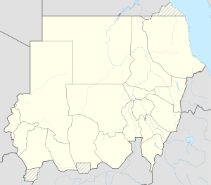
| Lage des Bundesstaates Dschanub Darfur in Sudan | ||
| Geographische Lage | westl. | |
| Zuflüsse | Wadi Ibra | |
| Abfluss | keine | |
| Ufernaher Ort | Nyala | |
| Daten | ||
| Koordinaten | 10° 43′ 0″ N, 25° 15′ 0″ O | |
| ||
| Höhe über Meeresspiegel | 460 m | |
| Fläche | 20 km² | |
| Mittlere Tiefe | 2–3 m | |
Beschreibung
Der flache See wird durch den Wadi Ibra gespeist. In den Dürre-Perioden verkleinert sich der See von 20 km² auf eine Fläche von 1 bis 2 km².
Die See-Flora umfasst unter anderem Seerosen, Raues Hornblatt (Ceratophyllum demersum) und das Nixenkraut Najas pectinata.
Siehe auch
- Liste der Gewässer im Sudan
На других языках
- [de] Kundi-See
[en] Lake Kundi
Lake Kundi (Swahili: "group") is located in South Darfur, Sudan, Africa. The perennial,[1] endorheic lake is situated at the mouth of Ibrah River, near the seasonal Bahr al-Arab.[2] The nearest town is Al-Fashir, 350 kilometres (220 mi) to the north. The 20 square kilometres (7.7 sq mi) lake reaches 1,200 hectares (3,000 acres) at high water, shrinking to 100–200 hectares (250–490 acres) in the dry season.[3] The lake is shallow, 2–3 metres (6 ft 7 in – 9 ft 10 in) in depth, depending upon the season. The lake is situated at an altitude of 460 metres (1,510 ft) above sea level.[4] Radom National Park is located to the southwest.[5][es] Lago Kundi
Lago Kundi es el nombre de un lago africano que se encuentra en el sur de Darfur, Sudán.[1] La ciudad más cercana es Al-Fashir, a 350 kilómetros (220 millas) al norte. El lago de 20 km² (7,7 millas cuadradas) crece 1.200 hectáreas (3.000 acres) con las aguas altas, con una reducción de 100 a 200 hectáreas (250 hasta 490 acres) en la estación seca.[2] El lago es poco profundo, de 2 a 3 metros de profundidad, dependiendo de la temporada. El lago está situado a una altitud de 460 metros (1.510 pies) sobre el nivel del mar.[3] El Parque nacional Radom se encuentra en el suroeste.Текст в блоке "Читать" взят с сайта "Википедия" и доступен по лицензии Creative Commons Attribution-ShareAlike; в отдельных случаях могут действовать дополнительные условия.
Другой контент может иметь иную лицензию. Перед использованием материалов сайта WikiSort.org внимательно изучите правила лицензирования конкретных элементов наполнения сайта.
Другой контент может иметь иную лицензию. Перед использованием материалов сайта WikiSort.org внимательно изучите правила лицензирования конкретных элементов наполнения сайта.
2019-2025
WikiSort.org - проект по пересортировке и дополнению контента Википедии
WikiSort.org - проект по пересортировке и дополнению контента Википедии