geo.wikisort.org - Stillgewässer
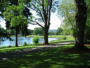
Der Lake Sacajawea ist ein kleiner See im Zentrum von Longview im US-Bundesstaat Washington. Er liegt innerhalb des Lake Sacajawea Park und ist eingebunden zwischen dem Kessler Boulevard und dem Nichols Boulevard. Seine Fläche beträgt 24,7 Hektar und wird vom Cowlitz River gespeist.[1][2][3][4]
| Lake Sacajawea | ||
|---|---|---|
 | ||
| Geographische Lage | Longview, Washington, USA | |
| Zuflüsse | vom Cowlitz River | |
| Daten | ||
| Koordinaten | 46° 8′ 6″ N, 122° 57′ 7″ W | |
|
| ||
| Höhe über Meeresspiegel | 3 m | |
| Fläche | 24,7 ha | |
| Volumen | 435.419 m³ | |
| Umfang | 7,4 km | |
| Maximale Tiefe | 6,4 m | |
| Mittlere Tiefe | 1,8 m | |
| Einzugsgebiet | 12,9 km² | |
Weitere Daten des Sees sind: Einzugsgebiet 12,9 km², Durchschnittstiefe 1,8 Meter, Maximale Tiefe 6,4 Meter, Kapazitätvolumen 435.419 Kubikmeter, Uferlänge 7,4 Kilometer, Höhe über dem Meeresspiegel 3 Meter.[4]
Seit sieben Jahren wird an dem innerstädtischen See ein Angeltag für Kinder organisiert.[5]
Weitere Namen
Weitere Bezeichnungen des Sees sind:
Siehe auch
Weblinks
Einzelnachweise
- Lake Sacajawea (See, Washington) im Geographic Names Information System des United States Geological Survey
- Photo #12135 - Lake Sacajawea, Longview Bordered by Kessler Blvd on the east and Nichols Blvd. on the west. Lake Sacajawea, a 60 acre lake within a 60 acre park - located in a... (Memento des Originals vom 9. Juli 2008 im Internet Archive) Info: Der Archivlink wurde automatisch eingesetzt und noch nicht geprüft. Bitte prüfe Original- und Archivlink gemäß Anleitung und entferne dann diesen Hinweis.
- City of Longview, Washington: Lake Sacajawea Park
- Sacajawea SACCO1 (PDF-Datei; 68 kB)
- WDFW FISHING RULE CHANGE: Martin's Dock at Lake Sacajawea will close to public for Kids Fish-In
- U.S. Geological Survey. Geographic Names Phase I data compilation (1976–1981). 31-Dec-1981. Primarily from U.S. Geological Survey 1:24,000-scale topographic maps (or 1:25K, Puerto Rico 1:20K) and from U.S. Board on Geographic Names files. In some instances, from 1:62,500 scale or 1:250,000 scale maps
- Miscellaneous Sources - A brief description and the year of publication (if known) follow: 1961/Lakes of WA
- Hitchman, Robert. Place Names of Washington. State Historical Society, 1985. ISBN 0-917048-57-1.
- Miscellaneous Sources - A brief description and the year of publication (if known) follow: 1961/Lakes of WA
На других языках
- [de] Lake Sacajawea (See, Washington)
[en] Lake Sacajawea (Longview, Washington)
Lake Sacajawea is a man-made lake in Longview, Washington. It is named after the Shoshone woman named Sacajawea who guided Meriwether Lewis and William Clark during their expedition to the Pacific Ocean. The lake is made up of four sections, each separated by a bridged road. Several small parks are part of the larger Lake Sacajawea Park. Lake Sacajawea Park is a 67-acre park in the middle of the city.[1] The lake's water is pumped into the north end from the Cowlitz River and flows to the south end where it exits into the Columbia River.[2]Текст в блоке "Читать" взят с сайта "Википедия" и доступен по лицензии Creative Commons Attribution-ShareAlike; в отдельных случаях могут действовать дополнительные условия.
Другой контент может иметь иную лицензию. Перед использованием материалов сайта WikiSort.org внимательно изучите правила лицензирования конкретных элементов наполнения сайта.
Другой контент может иметь иную лицензию. Перед использованием материалов сайта WikiSort.org внимательно изучите правила лицензирования конкретных элементов наполнения сайта.
2019-2025
WikiSort.org - проект по пересортировке и дополнению контента Википедии
WikiSort.org - проект по пересортировке и дополнению контента Википедии
