geo.wikisort.org - Montagne
Il Wildhorn (3.248 m s.l.m.) è una montagna delle Alpi Bernesi.
| Wildhorn | |
|---|---|
 | |
| Stato | |
| Cantone | |
| Altezza | 3 248 m s.l.m. |
| Prominenza | 978 m |
| Isolamento | 23 km |
| Catena | Alpi |
| Coordinate | 46°21′16.23″N 7°21′38.61″E |
| Data prima ascensione | settembre 1843 |
| Autore/i prima ascensione | Gottlieb Samuel Studer |
| Mappa di localizzazione | |
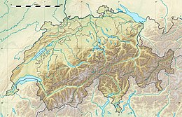 Wildhorn  | |
| Dati SOIUSA | |
| Grande Parte | Alpi Occidentali |
| Grande Settore | Alpi Nord-occidentali |
| Sezione | Alpi Bernesi |
| Sottosezione | Alpi Bernesi in senso stretto |
| Supergruppo | Catena Wildhorn-Wildstrubel |
| Gruppo | Gruppo del Wildhorn |
| Codice | I/B-12.II-F.16 |
Descrizione
Si trova lungo la linea di confine tra il Canton Vallese ed il Canton Berna.
La montagna fu scalata per la prima volta nel settembre 1843 da Gottlieb Samuel Studer. La via di salita più facile avviene partendo dal lago Iffig e passando dalla Wildhornhütte (2.303 m).
Altri progetti
 Wikimedia Commons contiene immagini o altri file su Wildhorn
Collegamenti esterni
- Il Wildhorn su camptocamp.org, su camptocamp.org.
| Controllo di autorità | VIAF (EN) 245403580 · GND (DE) 4527785-0 |
|---|
На других языках
[de] Wildhorn
Das Wildhorn ist mit 3248 m ü. M. die höchste Erhebung der Wildhorngruppe in den westlichen Berner Alpen in der Schweiz. Der Berg besitzt einen Doppelgipfel, wobei der Ostgipfel, auf dem sich das Gipfelkreuz befindet, nach aktuellen Messungen 2 m niedriger ist als der Westgipfel. Über den Berggipfel verläuft die Kantonsgrenze zwischen den Kantonen Wallis und Bern.[en] Wildhorn
The Wildhorn is a mountain of the Alps, straddling the border between the Swiss cantons of Bern and Valais. At 3,248 metres (10,656 ft) above sea level, it is the highest summit of the Bernese Alps west of the Gemmi Pass. It forms a large glaciated massif, about 10 km wide, extending between the Sanetsch Pass and the Rawil Pass. Along with the Muverans, the Diablerets and the Wildstrubel, the Wildhorn is one of the four distinct mountain massifs of the Bernese Alps that lie west of the Gemmi Pass. The massif of the Wildhorn is at the centre between the valleys of the Saane, Simme (both canton of Bern) and the Rhone (Valais).[3] It comprises several distinct summits, including (from west to east) the Arpelistock, Le Sérac, the Geltenhorn, the Sex Noir, the Sex Rouge, the Schnidehorn and the Six des Eaux Froides. The main crest is between the glaciers named Tungelgletscher and Glacier du Wildhorn. South of the main summit is the almost equally high summit of Mont Pucel (3,177 m). The Wildhorn is surrounded by several large mountain lakes: the Lac de Sénin, the Lauenensee, the Iffigsee, the Lac de Tseuzier and the Lac des Audannes. The Tungelgletscher, on the north-east face, was measured as 1.9 km in length in 1973.[4][fr] Wildhorn
Le Wildhorn est un sommet des Alpes bernoises en Suisse. Culminant à 3 250 mètres d'altitude, il se trouve à la frontière entre les cantons de Berne et Valais.- [it] Wildhorn
Текст в блоке "Читать" взят с сайта "Википедия" и доступен по лицензии Creative Commons Attribution-ShareAlike; в отдельных случаях могут действовать дополнительные условия.
Другой контент может иметь иную лицензию. Перед использованием материалов сайта WikiSort.org внимательно изучите правила лицензирования конкретных элементов наполнения сайта.
Другой контент может иметь иную лицензию. Перед использованием материалов сайта WikiSort.org внимательно изучите правила лицензирования конкретных элементов наполнения сайта.
2019-2026
WikiSort.org - проект по пересортировке и дополнению контента Википедии
WikiSort.org - проект по пересортировке и дополнению контента Википедии