geo.wikisort.org - Montagne
Il Tonelagee (in gaelico irlandese Tóin le Gaoith[1]) è una montagna dei monti Wicklow (Irlanda), la terza per altezza dopo il Lugnaquilla e il Mullaghcleevaun.
| Tonelagee Tóin le Gaoith | |
|---|---|
 | |
| Stato | |
| Provincia | |
| Contea | |
| Altezza | 817 m s.l.m. |
| Prominenza | 204 m |
| Isolamento | 5,43 km |
| Catena | Monti Wicklow |
| Coordinate | 53°03′12.98″N 6°22′55.82″W |
| Mappa di localizzazione | |
 Tonelagee Tóin le Gaoith | |
Geografia
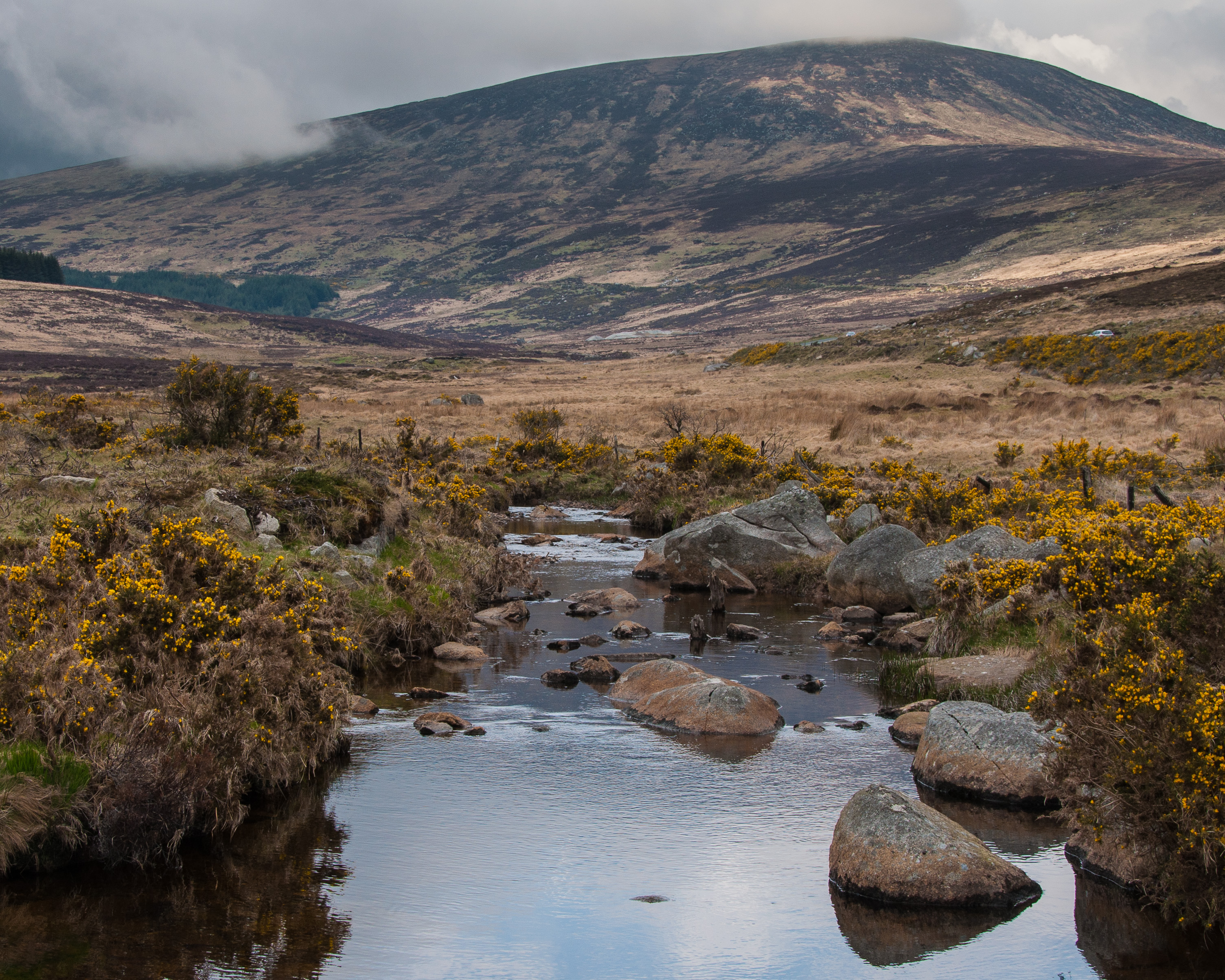
La montagna, dell'altezza di 817 m e con una prominenza topografica di 202 m[2], è collocata a nord-est del Wicklow Gap. Il crinale prosegue in direzione nord verso il Mullaghcleevaun (847 m). Per le sue caratteristiche di altitudine e di prominenza topografica il Tonelagee viene incluso tra i Marilyn.[2] A nord-est del suo punto culminante si trova un lago chiamato Laugh Ouler.
Sulla cima si trova un pilastrino trigonometrico in cemento. Il panorama dal punto culminante comprende le principali cime dei monti Wicklow, un lungo tratto della costa orientale irlandese con, in Galles.
Accesso alla cima

La via di salita che parte dal Wicklow Gap non richiede particolari abilità escursionistiche o alpinistiche, ma è consigliabile essere provvisti di vestiti e calzature adeguati nonché una discreta forma fisica. Un altro itinerario per l'accesso al Tonelagee parte dalla cascata Glenmacnass e passa per il Lough Ouler.[3]
Tutela naturalistica
La montagna e l'area circostante sono incluse nel Parco nazionale dei Monti Wicklow.
Note
- (GA) Tóin le Gaoith, su Placenames Database of Ireland, Dublin City University. URL consultato il 30 novembre 2016.
- (EN) Tonelagee, su mountainviews.ie, Ordnance Survey Ireland. URL consultato il 7 dicembre 2016.
- (EN) Paddy Dillon, The Mountains of Ireland: A Guide to Walking the Summits, Cicerone Press Limited, 2013, pp. 35-36. URL consultato il 18 marzo 2015.
Altri progetti
 Wikimedia Commons contiene immagini o altri file su Tonelagee
Collegamenti esterni
- (EN) Tonelagee, su Peakbagger.com.
На других языках
[en] Tonelagee
Tonelagee (Irish: Tóin le Gaoith, meaning 'backside to the wind')[2] at 817 metres (2,680 ft), is the 25th–highest peak in Ireland on the Arderin scale,[3] and the 33rd–highest peak on the Vandeleur-Lynam scale.[4][5] Tonelagee is situated in the central sector of the Wicklow Mountains range, and sits on the main "central spine" of the range that runs from Kippure in the north, to Lugnaquillia in the south; and in particular, the continuous "central boggy ridge" that runs from the Sally Gap in the north, via Mullaghcleevaun, to Tonelagee.[6] Tonelagee is the third highest peak in Wicklow after Lugnaquilla and Mullaghcleevaun.[7][fr] Tonelagee
Tonelagee (en irlandais : Tóin le Gaoith, littéralement « côté opposé au vent ») est le troisième plus haut sommet des montagnes de Wicklow, avec 817 mètres d'altitude, en Irlande. Il est situé au nord de Wicklow Gap.- [it] Tonelagee
Другой контент может иметь иную лицензию. Перед использованием материалов сайта WikiSort.org внимательно изучите правила лицензирования конкретных элементов наполнения сайта.
WikiSort.org - проект по пересортировке и дополнению контента Википедии