geo.wikisort.org - Montagne
Il monte Smólikas è il più alto dei rilievi dell'Epiro e di tutta la catena montuosa del Pindo. Culmina a 2637 m, ha una formazione calcarea e una ricca vegetazione.
| Smólikas | |
|---|---|
| Stato | |
| Periferia | Epiro |
| Altezza | 2 637 m s.l.m. |
| Prominenza | 1 736 m |
| Catena | Pindo |
| Coordinate | 40°05′50″N 20°55′30″E |
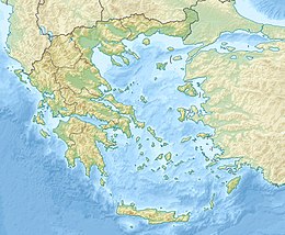
| Mappa di localizzazione | |
Altri progetti
 Wikimedia Commons contiene immagini o altri file su Smólikas
Collegamenti esterni
- (EN) Smólikas, su Enciclopedia Britannica, Encyclopædia Britannica, Inc.
- (EN) Smólikas, su Peakware.com.
- (EN) Smólikas, su Peakbagger.com.
На других языках
[de] Smolikas
Der Smolikas (griechisch Σμόλικας, auch Lyngos neugriechisch Λύγκος, altgriechisch Λύγγος, transkr. auch Lingos oder Ligos; aromunisch Smolcu) ist mit einer Höhe von 2637 m das zweithöchste Bergmassiv in Griechenland nach dem Olymp und zugleich der höchste Berg des Pindos-Gebirges. Er befindet sich im Regionalbezirk Ioannina der Region Epirus in Nordwestgriechenland in der Nähe der albanischen Grenze. Im Südwesten liegen die Städte Konitsa und Ioannina, im Norden entfernt Kastoria, im Nordwesten entfernt Neapolis und Kozani, im Südosten Metsovo und im Osten Grevena.[en] Smolikas
Mount Smolikas (Greek: Σμόλικας; Aromanian: Smolcu) is a mountain in the Ioannina regional unit, northwestern Greece. At a height of 2,637 metres above sea level, it is the highest of the Pindus Mountains, and the second highest mountain in Greece after Mount Olympus. The mountain consists of ophiolite rocks. During several periods in the Pleistocene the northern and eastern cirques and valleys were glaciated. The last glaciers of this area retreated around 11,500 years ago.[2] It is drained by the river Vjosa to the south, and the river Vourkopotamo (a tributary of the Sarantaporos) to the north. There is a small alpine lake called "Drakolimni Smolika" near the summit, at about 2,200 metres elevation. Nearby mountain ranges are Tymfi to the south, Gramos to the northwest, Vasilitsa to the southeast and Voio to the northeast.[es] Smolikas
El monte Smolikas (en griego: Σμόλικας, en aromano: Smolcu) es una montaña de la unidad periférica de Ioánina, en el noroeste de Grecia. Con una altura de 2637 metros sobre el nivel del mar, es la más alta de las montañas del Pindo, y la segunda montaña más alta de Grecia después del monte Olimpo. La montaña está formada por rocas ofiolíticas. Durante varios periodos del Pleistoceno, los circos y valles del norte y del este se cubrieron de glaciares. Los últimos glaciares de esta zona se retiraron hace unos once mil quinientos años.[1] Está drenada por el río Aoos al sur, y por el río Vourkopotamo (un afluente del Sarantaporos) al norte. Hay un pequeño lago alpino llamado "Drakolimni Smolika" cerca de la cumbre, a unos 2.200 metros de altitud. Las cadenas montañosas cercanas son Tymfi al sur, Grammos al noroeste, Vasilitsa al sureste y Voio al noreste.[fr] Smólikas
Le Smólikas (en grec moderne : Σμόλικας), avec ses 2 637 mètres d'altitude, est le plus haut sommet du massif du Pinde, dans le Nord-Ouest de la Grèce. Il est le deuxième plus haut sommet du pays après le mont Olympe. Il est constitué d'ophiolites.- [it] Smólikas
[ru] Змоликас
Змо́ликас[1] (Смолика[3][4][5], греч. Σμόλικας, арум. Smolcu) — гора на северо-западе Греции. Находится в горах Пинд, к югу от хребта Грамос, в периферийной единице Янине в периферии Эпире. Вторая по высоте после Олимпа вершина в Греции. Высота вершины составляет 2637 метров над уровнем моря[1]. К горе примыкают два национальных заповедника. Её длина составляет примерно от 15 до 20 км с востока на запад, а ширина около 10 км с севера на юг.Текст в блоке "Читать" взят с сайта "Википедия" и доступен по лицензии Creative Commons Attribution-ShareAlike; в отдельных случаях могут действовать дополнительные условия.
Другой контент может иметь иную лицензию. Перед использованием материалов сайта WikiSort.org внимательно изучите правила лицензирования конкретных элементов наполнения сайта.
Другой контент может иметь иную лицензию. Перед использованием материалов сайта WikiSort.org внимательно изучите правила лицензирования конкретных элементов наполнения сайта.
2019-2025
WikiSort.org - проект по пересортировке и дополнению контента Википедии
WikiSort.org - проект по пересортировке и дополнению контента Википедии
