geo.wikisort.org - Montagne
Il Rocher Rond (2.453 m s.l.m.[1]) è una montagna delle Prealpi del Devoluy. Costituisce la massima elevazione del dipartimento della Drôme.
| Rocher Rond | |
|---|---|
 | |
| Stato | |
| Regione | |
| Dipartimento | Drôme |
| Altezza | 2 453 m s.l.m. |
| Catena | Alpi |
| Coordinate | 44°41′48.01″N 5°49′37.13″E |
| Mappa di localizzazione | |
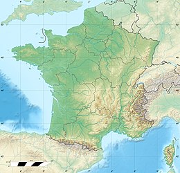 Rocher Rond  | |
| Dati SOIUSA | |
| Grande Parte | Alpi Occidentali |
| Grande Settore | Alpi Sud-occidentali |
| Sezione | Prealpi del Delfinato |
| Sottosezione | Prealpi del Devoluy |
| Supergruppo | Catena Grande Tête de l'Obiou-Roc de Garnesier |
| Gruppo | Gruppo del Roc de Garnesier |
| Sottogruppo | Cresta Roc de Garnesier-Aiguilles |
| Codice | I/A-6.I-B.3.a |
Costituisce inoltre il punto culminante del parco naturale regionale del Vercors.
Note
- (FR) Hervé Galley e Emmanuel Cabau, Ski de randonnée Isère: Chartreuse, Vercors, Dévoluy, Beaumont, Taillefer, Belledonne, Grandes Rousses, Ecrins, Editions Olizane, 2017. URL consultato il 24 marzo 2021.
Collegamenti esterni
- (EN) Rocher Rond, su Peakbagger.com.
На других языках
[en] Rocher Rond
The Rocher Rond (round rock) is a summit in the Dévoluy massif of the French Alps. It is the highest point of the Vercors Regional Natural Park, although it is not part of the Vercors massif, and also the highest point in the department of Drôme.[1] It has an elevation of 2453 metres, and an isolation of 8.77 km.[2] It is the 14th highest French department highpoint.[2][fr] Rocher Rond
Le rocher Rond est un sommet des Alpes françaises culminant à 2 453 mètres d'altitude et qui constitue le point culminant de la Drôme et du parc naturel régional du Vercors. Situé dans le massif du Dévoluy, il se trouve à cheval sur le territoire des communes de Lus-la-Croix-Haute dans la Drôme et de Dévoluy dans les Hautes-Alpes, à environ 36 kilomètres de Die.- [it] Rocher Rond
Текст в блоке "Читать" взят с сайта "Википедия" и доступен по лицензии Creative Commons Attribution-ShareAlike; в отдельных случаях могут действовать дополнительные условия.
Другой контент может иметь иную лицензию. Перед использованием материалов сайта WikiSort.org внимательно изучите правила лицензирования конкретных элементов наполнения сайта.
Другой контент может иметь иную лицензию. Перед использованием материалов сайта WikiSort.org внимательно изучите правила лицензирования конкретных элементов наполнения сайта.
2019-2026
WikiSort.org - проект по пересортировке и дополнению контента Википедии
WikiSort.org - проект по пересортировке и дополнению контента Википедии