geo.wikisort.org - Montagne
Il Monte Parnone, (in greco: Πάρνωνας), è un monte della Grecia, costituito in prevalenza di calcare, alto circa 1.940 metri, situato a oriente della Laconia, che separa dall'Arcadia.
|
Questa voce o sezione sull'argomento montagne della Grecia non cita le fonti necessarie o quelle presenti sono insufficienti.
|
| Monte Parnone | |
|---|---|
 | |
| Stato | |
| Periferia | Peloponneso |
| Altezza | 1 940 m s.l.m. |
| Coordinate | 37°03′43.92″N 22°26′05.28″E |
| Mappa di localizzazione | |
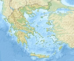 Monte Parnone | |
La montagna è visibile da Atene.
Voci correlate
- Ano Doliana
Altri progetti
 Wikimedia Commons contiene immagini o altri file su Parnone
На других языках
[de] Parnon-Gebirge
Das Parnon-Gebirge (griechisch Πάρνωνας .mw-parser-output .Latn{font-family:"Akzidenz Grotesk","Arial","Avant Garde Gothic","Calibri","Futura","Geneva","Gill Sans","Helvetica","Lucida Grande","Lucida Sans Unicode","Lucida Grande","Stone Sans","Tahoma","Trebuchet","Univers","Verdana"}Párnonas) ist ein Gebirgszug im Südosten der griechischen Halbinsel Peloponnes. Es erstreckt sich über eine Länge von etwa 60 km in Richtung NW–SSO. Seine höchste Erhebung ist mit 1940 m die Megali Tourla. Der südwestliche Teil dieses Gebirges liegt in der Präfektur Lakonien, der nordöstliche in der Präfektur Arkadien. Ein Teil der Grenze zwischen diesen beiden Präfekturen verläuft auf dem Kamm des Parnon-Gebirges.[en] Parnon
Parnon or Parnonas (Greek: Πάρνων/Πάρνωνας) or Malevos (Μαλεβός) is a mountain range, or massif, on the east of the Laconian plain and the Evrotas valley. It is visible from Athens above the top of the Argive mountains.[citation needed] The western part is in the Laconia prefecture and the northeastern part is in the Arcadia prefecture. The Parnon range separates Laconia from Arcadia. Its summit offers panoramic views of southeastern Arcadia and South Kynouria and much of Laconia that includes the northern and the central portions and reaches as far as the Taygetos mountains. It also views a part of the central Arcadia and the southern Argolis prefectures. It views the Myrtoan and the Laconian Gulfs.[fr] Parnon
Le Parnon (en grec ancien Πάρνων) est une montagne qui sépare la Laconie de l'Arcadie non loin de Sparte ; le Tanaus y prend sa source.- [it] Parnone
[ru] Парнон
Па́рнон[1][2][3][4][5] (др.-греч. Πάρνον, греч. Πάρνωνας), также Малево (Μαλεβός) — горный хребет в Греции. Находится на юго-востоке полуострова Пелопоннес. Длина около 100 км, высота до 1935 метров[1][6]. Другие вершины — Псари (Ψαρή) высотой 1839 м[3][4]. Восточный склон крутой, западный пологий. Склоны покрыты кустарниками. На вершинах растёт сосновый и пихтовый лес.Текст в блоке "Читать" взят с сайта "Википедия" и доступен по лицензии Creative Commons Attribution-ShareAlike; в отдельных случаях могут действовать дополнительные условия.
Другой контент может иметь иную лицензию. Перед использованием материалов сайта WikiSort.org внимательно изучите правила лицензирования конкретных элементов наполнения сайта.
Другой контент может иметь иную лицензию. Перед использованием материалов сайта WikiSort.org внимательно изучите правила лицензирования конкретных элементов наполнения сайта.
2019-2026
WikiSort.org - проект по пересортировке и дополнению контента Википедии
WikiSort.org - проект по пересортировке и дополнению контента Википедии