geo.wikisort.org - Montagne
Il Monte Otri (in greco moderno: Όθρυς, traslitterato: Óthrys) è una montagna della Grecia centrale, alta 1726 m.s.l.m..[1] Si trova tra le unità periferiche della Ftiotide e della Magnesia.
|
Questa voce o sezione sull'argomento mitologia greca non cita le fonti necessarie o quelle presenti sono insufficienti.
|
| Otri | |
|---|---|
 | |
| Stato | |
| Altezza | 1 726 m s.l.m. |
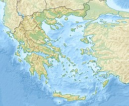
| Coordinate | 39°01′01″N 22°42′35″E |
| Mappa di localizzazione | |
 Otri | |
Mitologia
Il Monte Otri era, nella mitologia greca, la base dei Titani nella Titanomachia, la guerra dei Titani contro gli dei del Monte Olimpo. Si dice che nel Monte Otri si trovasse il trono di Crono, Signore del Tempo e dei Titani, sorvegliato da Crio, Titano Signore del Sud.
Influenza culturale
- Il Monte Otri è presente nella saga Percy Jackson e gli dei dell'Olimpo. Percy Jackson combatte nell'Otri contro il Titano Atlante nel libro Percy Jackson e gli dei dell'Olimpo: la maledizione del Titano.
Voci correlate
Note
- Oreivatein.com. URL consultato il 10 maggio 2022 (archiviato dall'url originale il 16 ottobre 2013).
Altri progetti
 Wikimedia Commons contiene immagini o altri file su Otri
Collegamenti esterni
На других языках
[de] Othrys
Die Othrys (griechisch Όθρυς (f. sg.)) ist ein Gebirge in Griechenland, südlich der thessalischen Ebene.[en] Mount Othrys
Mount Othrys (Greek: όρος Όθρυς – oros Othrys, also Όθρη – Othri) is a mountain range of central Greece, in the northeastern part of Phthiotis and southern part of Magnesia. Its highest summit, Gerakovouni, situated on the border of Phthiotis and Magnesia, is 1,726 m (5,663 ft) above sea level.[1] The population density in the mountains is low: there are a few small villages, including Anavra in the northwest, Kokkotoi in the northeast, Palaiokerasia in the south and Neraida in the southwest. The length from west to east is about 35 km (22 mi) and the width from north to south is about 25 km (16 mi). The Pagasetic Gulf lies to the northeast, and the Malian Gulf lies to the south. The summit Gerakovouni lies 19 km (12 mi) south of Almyros, 27 km (17 mi) northeast of Lamia and 44 km (27 mi) southwest of Volos. The peaks of the range are above the tree line. The main mineral constituent of the rock is ophiolite.[fr] Mont Othrys
Le mont Othrys est une montagne dans le centre de la Grèce[1].- [it] Otri
[ru] Отрис
О́трис[1] (греч. Όθρυς) — горный хребет в Греции, на границе периферийных единиц Фтиотида и Магнисия. Отделяет Фессалийскую равнину, долину реки Пиньос и залив Пагаситикос от долины реки Сперхиос и залива Малиакос на юге. Длина около 90 км, высота до 1726 метров над уровнем моря[1]. Хребет простирается от горы Велухи на западе до побережья Эгейского моря на востоке. Сложен кристаллическими породами, перекрытыми на западе песчаниками, сланцами и известняками. На склонах — средиземноморская кустарниковая растительность, отдельные рощи из дуба, а выше 1000 метров — из ели. Зимние пастбища[2][3]. На Отрисе берёт начало река Энипефс[4]. Самый высокий пик — Гиузи или Ераковуни (Γκιούζι ή Γερακοβούνι). Другие пики: Профитис-Илиас (Προφήτης Ηλίας, 1694 м), Маврикас (Μαυρίκας, 1578 м), Ксеровуни (Ξεροβούνι, 1454 м), Арапас (Αραπάς, 1291 м). Восточной оконечностью является гора Траговуни (Τραγοβούνι, 639 м) на мысе Ставрос (Σταυρός) у входа в залив Пагаситикос.Текст в блоке "Читать" взят с сайта "Википедия" и доступен по лицензии Creative Commons Attribution-ShareAlike; в отдельных случаях могут действовать дополнительные условия.
Другой контент может иметь иную лицензию. Перед использованием материалов сайта WikiSort.org внимательно изучите правила лицензирования конкретных элементов наполнения сайта.
Другой контент может иметь иную лицензию. Перед использованием материалов сайта WikiSort.org внимательно изучите правила лицензирования конкретных элементов наполнения сайта.
2019-2026
WikiSort.org - проект по пересортировке и дополнению контента Википедии
WikiSort.org - проект по пересортировке и дополнению контента Википедии