geo.wikisort.org - Montagne
Il monte Rantemario (in indonesiano Bulu Rantemario) è una montagna dell'Indonesia di 3.478 metri[1], cima più alta dell'isola di Sulawesi.
| Monte Rantemario | |
|---|---|
| Stato | |
| Altezza | 3 478 m s.l.m. |
| Prominenza | 3 478 m |
| Isolamento | 682 km |
| Coordinate | 3°23′06″S 120°01′27.01″E |
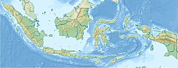
| Mappa di localizzazione | |
Note
- Gunung Rantemario, Indonesia, su Peakbagger.com. URL consultato il 6 luglio 2014.
Voci correlate
- Elenco di montagne
Collegamenti esterni
- (EN) Monte Rantemario, su Peakbagger.com.
На других языках
[de] Rantemario
Der Rantemario (Indonesisch: Bulu Rantemario) ist der höchste Berg auf Sulawesi und liegt in der Provinz Sulawesi Selatan. Es gibt allerdings Quellen, die den nahegelegenen Gunung Rantekombola als höchsten Berg der Insel bezeichnen.[en] Mount Latimojong
Latimojong (Indonesian: Gunung Latimojong), also known by its peak name Rantemario, is a mountain located in the province of South Sulawesi, Sulawesi, Indonesia. At 3,478 metres (11,411 ft), it is the highest mountain on the island,[1][2] although some sources state Mount Rantekombola as the highest point.[fr] Rantemario
Le Rantemario (en indonésien : Bulu Rantemario, nom du sommet) ou Latimojong (Gunung Latimojong, nom du massif) est une montagne située dans la province du Sulawesi du Sud en Indonésie. Avec une altitude de 3 478 mètres[1], c'est le point culminant de l'île de Célèbes.- [it] Monte Rantemario
Текст в блоке "Читать" взят с сайта "Википедия" и доступен по лицензии Creative Commons Attribution-ShareAlike; в отдельных случаях могут действовать дополнительные условия.
Другой контент может иметь иную лицензию. Перед использованием материалов сайта WikiSort.org внимательно изучите правила лицензирования конкретных элементов наполнения сайта.
Другой контент может иметь иную лицензию. Перед использованием материалов сайта WikiSort.org внимательно изучите правила лицензирования конкретных элементов наполнения сайта.
2019-2025
WikiSort.org - проект по пересортировке и дополнению контента Википедии
WikiSort.org - проект по пересортировке и дополнению контента Википедии
