geo.wikisort.org - Montagne
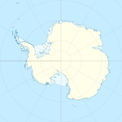
Le montagne di Lomonosov sono una catena montuosa dell'Antartide facente parte del più grande insieme montuoso chiamato Fimbulheimen, di cui costituisce l'estremità orientale. Situata nella Terra della Regina Maud e in particolare in corrispondenza della costa della Principessa Astrid, la formazione si snoda in direzione nord est-sud ovest per oltre 33 km a est delle montagne di Hoel.
| Montagne di Lomonosov | |
|---|---|
| Continente | Antartide |
| Stati | |
| Lunghezza | 33 km |
Storia
Le montagne di Lomonosov sono state scoperte e fotografate durante la spedizione Nuova Svevia, 1938-39, comandata dal capitano tedesco Alfred Ritscher. In seguito esse sono state nuovamente esplorate dalla sesta spedizione antartica norvegese, 1956-60, e poi da una spedizione di ricerca sovietica nel 1960-61. Proprio quest'ultima ha poi così ribattezzato la formazione in onore dello scienziato sovietico Michail Vasil'evič Lomonosov.[1]
Note
- (EN) Montagne di Lomonosov, in Geographic Names Information System, USGS.
Collegamenti esterni
- (EN) Montagne di Lomonosov, su Geographic Names Information System per l'Antartico, USGS.
На других языках
[de] Lomonossowgebirge
Das Lomonossowgebirge (russisch Горі Ломоно́сов, norwegisch Lomonosovfjellet) ist ein weitgehend isolierter Gebirgszug im ostantarktischen Königin-Maud-Land. Er erstreckt sich 30 km östlich des Wohlthat-Massivs über eine Länge von 28 km in nordost-südwestlicher Ausrichtung.[en] Lomonosov Mountains
The Lomonosov Mountains (.mw-parser-output .geo-default,.mw-parser-output .geo-dms,.mw-parser-output .geo-dec{display:inline}.mw-parser-output .geo-nondefault,.mw-parser-output .geo-multi-punct{display:none}.mw-parser-output .longitude,.mw-parser-output .latitude{white-space:nowrap}71°31′S 15°20′E) are a somewhat isolated chain of mountains extending 18 nautical miles (33 km) northeast–southwest, located 20 nautical miles (37 km) east of the Wohlthat Mountains in Queen Maud Land, Antarctica. They were discovered and first plotted from air photos by the Third German Antarctic Expedition, 1938–39, and were mapped from air photos and surveys by the Sixth Norwegian Antarctic Expedition, 1958–59. The mountains were remapped by the Soviet Antarctic Expedition, 1960–61, and named after Russian scientist Mikhail Lomonosov.[1]- [it] Montagne di Lomonosov
Другой контент может иметь иную лицензию. Перед использованием материалов сайта WikiSort.org внимательно изучите правила лицензирования конкретных элементов наполнения сайта.
WikiSort.org - проект по пересортировке и дополнению контента Википедии
