geo.wikisort.org - Montagne
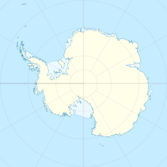
Le montagne di Gruber sono una catena montuosa dell'Antartide facente parte del più grande insieme montuoso chiamato montagne di Wohlthat, di cui costituiscono la parte nord-orientale. Situata nella Terra della Regina Maud e in particolare in corrispondenza della costa della Principessa Astrid, la formazione è composta da un massiccio principale circondato da diversi affioramenti rocciosi e le sue vette raggiungono i 2.460 m s.l.m. con il monte Bastei.
| Montagne di Gruber | |
|---|---|
| Continente | Antartide |
| Stati | |
| Cima più elevata | Monte Bastei (2.460 m s.l.m.) |
Storia
Le montagne di Gruber sono state scoperte e fotografate durante la spedizione Nuova Svevia, 1938-39, comandata dal capitano tedesco Alfred Ritscher. In seguito esse sono state nuovamente esplorate dalla sesta spedizione antartica norvegese, 1956-60, che le ha così battezzate in onore del cartografo tedesco Otto von Gruber, che per primo delineò le mappe di questa zona grazie alle fotografie scattate durante la sopraccitata spedizione tedesca.[1]
Note
- (EN) Montagne di Gruber, in Geographic Names Information System, USGS.
Collegamenti esterni
- (EN) Montagne di Gruber, su Geographic Names Information System per l'Antartico, USGS.
На других языках
[de] Otto-von-Gruber-Gebirge
Das Otto-von-Gruber-Gebirge ist ein kleines Gebirge, bestehend aus einem Hauptmassiv und verschiedenen Nunatakker in der Antarktis. Es bildet den nordöstlichen Teil des Wohlthatmassivs im zentralen Königin-Maud-Land.[en] Gruber Mountains
The Gruber Mountains (German: Otto-von-Gruber-Gebirge) are a small group of mountains consisting of a main massif and several rocky outliers, forming the northeast portion of the Wohlthat Mountains in Queen Maud Land, Antarctica. They were discovered and plotted from air photos by the Third German Antarctic Expedition (GerAE), 1938–39, under Alfred Ritscher. The mountains were remapped by the Sixth Norwegian Antarctic Expedition, 1956–60, who named them for Otto von Gruber, the German cartographer who compiled maps of this area from air photos taken by the GerAE. This feature is not to be confused with "Gruber-Berge," an unidentified toponym applied by the GerAE in northern the Mühlig-Hofmann Mountains.[1]- [it] Montagne di Gruber
Другой контент может иметь иную лицензию. Перед использованием материалов сайта WikiSort.org внимательно изучите правила лицензирования конкретных элементов наполнения сайта.
WikiSort.org - проект по пересортировке и дополнению контента Википедии
