geo.wikisort.org - Montagne
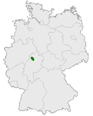
La Kellerwald è una catena montuosa dell'Assia, nella Germania centrale. Situata a circa 40 chilometri a sud-ovest di Kassel, culmina nell'altura del Wüstegarten, a 675 metri sul livello del mare. La parte settentrionale della catena è compresa nel Parco nazionale di Kellerwald-Edersee.
| Kellerwald | |
|---|---|
 | |
| Continente | Europa |
| Stati | |
| Cima più elevata | Wüstegarten (675,3 m s.l.m.) |
| Massicci principali | Massiccio scistoso renano |
Altri progetti
 Wikimedia Commons contiene immagini o altri file su Kellerwald
| Controllo di autorità | VIAF (EN) 237740572 · GND (DE) 4110066-9 |
|---|
На других языках
[de] Kellerwald
Der Kellerwald ist ein bis 675,3 m ü. NHN[1] hohes und 514,5 km²[2] großes Mittelgebirge in Hessen, Deutschland. Er liegt im westlichen Zentrum des Westhessischen Berg- und Senkenlands an dessen Nahtstelle zu den Ausläufern des Rothaargebirges und ist Teil des Rheinischen Schiefergebirges.[en] Kellerwald
The Kellerwald is a low mountain range reaching heights of up to 675 m in the western part of northern Hesse, Germany. Its assets include Germany's largest contiguous beech woodland and it contains Hesse's only national park, the Kellerwald-Edersee National Park. It is a UNESCO World Heritage Site.[1][es] Kellerwald
El Kellerwald es una cadena montañosa de Alemania que forma parte del Rheinisches Schiefergebirge, con el Wüstegarten (675 msnm) como su cumbre más alta.- [it] Kellerwald
Текст в блоке "Читать" взят с сайта "Википедия" и доступен по лицензии Creative Commons Attribution-ShareAlike; в отдельных случаях могут действовать дополнительные условия.
Другой контент может иметь иную лицензию. Перед использованием материалов сайта WikiSort.org внимательно изучите правила лицензирования конкретных элементов наполнения сайта.
Другой контент может иметь иную лицензию. Перед использованием материалов сайта WikiSort.org внимательно изучите правила лицензирования конкретных элементов наполнения сайта.
2019-2026
WikiSort.org - проект по пересортировке и дополнению контента Википедии
WikiSort.org - проект по пересортировке и дополнению контента Википедии