geo.wikisort.org - Montagne
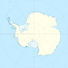
Le cime Pianeta sono una catena montuosa situata sulla costa orientale dell'isola Alessandro I, al largo della costa della Terra di Palmer, in Antartide. La formazione si trova in particolare tra la dorsale LeMay, a ovest, e il canale di Giorgio VI, a est, e si estende in direzione nord-sud per circa 97 km, essendo delimitata a nord dal ghiacciaio Giove, che la separa delle cime Ganimede, e a sud dal ghiacciaio Saturno.[1]
| Cime Pianeta | |
|---|---|
| Continente | Antartide |
| Stati | |
| Lunghezza | 97 km |
Storia
La catena delle cime Pianeta fu probabilmente avvistata per la prima volta da Lincoln Ellsworth, il quale, il 23 novembre 1935, effettuò una ricognizione aerea del segmento di costa in cui si trova la catena, fotografandolo. L'intera formazione è stata così battezzata dal Comitato britannico per i toponimi antartici in seguito a un'esplorazione effettuata nel 1948 e nel 1949 dal British Antarctic Survey (al tempo ancora chiamato "Falkland Islands Dependencies Survey", FIDS). Il nome deriva dal fatto che molte delle formazioni attorno alla catena montuosa erano già state battezzate con nomi di corpi celesti, come il ghiacciaio Plutone, il ghiacciaio Marte e il passo Via Lattea, che separa la catena dalla dorsale LeMay.[2]
Note
- Cime Pianeta, su sws.geonames.org, GeoNames.Org (cc-by), 20 gennaio 2008. URL consultato il 27 gennaio 2020.
- (EN) Cime Pianeta, in Geographic Names Information System, USGS.
Collegamenti esterni
- (EN) Cime Pianeta, su Geographic Names Information System per l'Antartico, USGS.
На других языках
[de] Planet Heights
Die Planet Heights sind ein 38,5 km langer Höhenzug im Osten der Alexander-I.-Insel westlich der Antarktischen Halbinsel. Sie umfassen eine Reihe von Berggipfeln entlang eines Gebirgskamms mit nord-südlicher Ausrichtung zwischen dem südlichen Abschnitt der LeMay Range und dem George-VI-Sund.[en] Planet Heights
Planet Heights (.mw-parser-output .geo-default,.mw-parser-output .geo-dms,.mw-parser-output .geo-dec{display:inline}.mw-parser-output .geo-nondefault,.mw-parser-output .geo-multi-punct{display:none}.mw-parser-output .longitude,.mw-parser-output .latitude{white-space:nowrap}71°13′S 68°47′W) is a series of summits running along an ice-free ridge, extending 24 nautical miles (44 km) in a north-south direction between the southernmost extremity of the LeMay Range and George VI Sound in the east part of Alexander Island, Antarctica. Many landforms and nearby features are named in association with this mountain range; some of these include landforms named after astronomers, satellites, planets and other things related to astrology and astrophysics. The mountain range was first mapped from air photos taken by the Ronne Antarctic Research Expedition (RARE), 1947–48, by Searle of the Falkland Islands Dependencies Survey (FIDS) in 1960. Named by the United Kingdom Antarctic Place-Names Committee (UK-APC) from association with the nearby glaciers named for planets of the Solar System. The only planet that is not featured in any of these glaciers is the planet Earth, as there are no glaciers named "Earth Glacier" and this glacier does not exist.- [it] Cime Pianeta
Другой контент может иметь иную лицензию. Перед использованием материалов сайта WikiSort.org внимательно изучите правила лицензирования конкретных элементов наполнения сайта.
WikiSort.org - проект по пересортировке и дополнению контента Википедии
