geo.wikisort.org - Montagne
Le Wellhorn est une montagne des Alpes bernoises culminant à 3 191 m.

| Wellhorn | |
 Vue du glacier de Rosenlaui (à gauche) et du Wellhorn (au centre) depuis le nord. | |
| Géographie | |
|---|---|
| Altitude | 3 191 m[1] |
| Massif | Alpes bernoises (Alpes) |
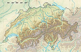
| Coordonnées | 46° 39′ 20″ nord, 8° 08′ 31″ est[1] |
| Administration | |
| Pays | |
| Canton | Berne |
| Arrondissement administratif | Interlaken-Oberhasli |
| Ascension | |
| Première | par Edmund von Fellenberg avec Michel et Peter Egger |
| Géologie | |
| Type | Pic pyramidal |
| modifier |
|
Il se situe au sud de la Reichenbachtal et à l’ouest du glacier de Rosenlaui. Les limites communales de Meiringen, Grindelwald, Innertkirchen et Schattenhalb se rejoignent à son sommet. À environ 1 km au nord-est de celui-ci se trouve le sommet du Klein Wellhorn (2 700 m).
La première ascension a eu lieu le par Edmund von Fellenberg avec Michel et Peter Egger sur la crête est[2].
Bibliographie
- Carte nationale de la Suisse au 1:50 000, feuille 5004 Oberland bernois, Office fédéral de topographie, Wabern, 2016 (ISBN 978-3-302-05004-1).
- « Wellhorn », Dictionnaire géographique de la Suisse, dixième volume, Attinger, Neuchâtel 1910, p. 612.
Références
- Visualisation sur Swisstopo.
- (de) Jahrbuch des Schweizer Alpenclub, Berne,
- Portail de la montagne
- Portail des Alpes
- Portail de la géographie de la Suisse
- Portail de l’Espace Mittelland
На других языках
[de] Wellhorn
Das Wellhorn ist ein Berg in den Berner Alpen.[en] Wellhorn
The Wellhorn is a mountain of the Bernese Alps, overlooking Rosenlaui in the Bernese Oberland. On its eastern side is the Rosenlaui Glacier.- [fr] Wellhorn
Текст в блоке "Читать" взят с сайта "Википедия" и доступен по лицензии Creative Commons Attribution-ShareAlike; в отдельных случаях могут действовать дополнительные условия.
Другой контент может иметь иную лицензию. Перед использованием материалов сайта WikiSort.org внимательно изучите правила лицензирования конкретных элементов наполнения сайта.
Другой контент может иметь иную лицензию. Перед использованием материалов сайта WikiSort.org внимательно изучите правила лицензирования конкретных элементов наполнения сайта.
2019-2025
WikiSort.org - проект по пересортировке и дополнению контента Википедии
WikiSort.org - проект по пересортировке и дополнению контента Википедии


