geo.wikisort.org - Montagne
Le Vranica fait partie d'un groupe montagneux du centre de la Bosnie-Herzégovine, dans les Alpes dinariques. Ce massif est géologiquement plus ancien que les massifs avoisinants, mais morphologiquement semblable. L'étagement de la végétation y est marqué avec des vallées boisées et des sommets au-delà de l'étage alpin. Le plus haut d'entre eux est le pic Nadkrstac, à 2 110 mètres d'altitude, suivi du pic Locika (2 107 m). À l'est de ces deux pics, le mont Vranica possède un lac glaciaire appelé Prokosko Jezero, à proximité du col Sarajevska vrata, où d'anciens abris de bergers ont été réaménagés en refuges pour les randonneurs[1].
Cet article est une ébauche concernant la montagne et la Bosnie-Herzégovine.
Vous pouvez partager vos connaissances en l’améliorant (comment ?) selon les recommandations des projets correspondants.
| Vranica | ||
 Vue du Vranica. | ||
| Géographie | ||
|---|---|---|
| Altitude | 2 110 m, pic Nadkrstac | |
| Massif | Alpes dinariques | |
| Coordonnées | 43° 57′ 25″ nord, 17° 42′ 58″ est | |
| Administration | ||
| Pays | ||
| Canton | Bosnie centrale | |
| Municipalités | Gornji Vakuf-Uskoplje, Fojnica, Novi Travnik | |
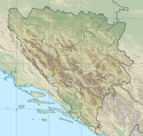
| Géolocalisation sur la carte : Bosnie-Herzégovine
| ||
| modifier |
||
Notes et références
- (en) Vranica, SummitPost.org
 Portail de la montagne
  Portail de la Bosnie-Herzégovine
На других языках
[de] Vranica
Vranica ist ein Massiv des Dinarischen Gebirges und liegt etwa 10 Kilometer westlich von Fojnica. Die höchste Bergspitze Nadkrstac ist mit 2112 m über dem Meeresspiegel die dritthöchste Erhebung von Bosnien und Herzegowina.[en] Vranica
Vranica (Serbian Cyrillic: Враница) is a mountain range in the Dinaric Alps of central Bosnia and Herzegovina, located between the town of Gornji Vakuf in the west and the town of Fojnica in the east, within the territory of the Federation. The highest peak is Nadkrstac at 2,110 metres (6,920 ft).[1] Geologically, the Vranica range is part of the Dinaric Alps and formed largely of secondary and tertiary sedimentary rock, mostly limestone. Notable peaks are Nadkrstac (2110 m.), Locika (2106 m.), Rosinj (2059 m.) and Scit (1949 m.). Thick shrubs of Pinus Mugo replace mixed forest -mostly beech- above 1400 m. The typical karst characteristics of the nearby Herzegovina mountains is relatively absent in Vranica, which has relatively abundant water sources. Streams that source from these mountains are the Dragača in the east, the Vrbas in the west.- [fr] Vranica
Другой контент может иметь иную лицензию. Перед использованием материалов сайта WikiSort.org внимательно изучите правила лицензирования конкретных элементов наполнения сайта.
WikiSort.org - проект по пересортировке и дополнению контента Википедии