geo.wikisort.org - Montagne
Le Tenakourou est le point culminant du Burkina Faso, à 747 mètres d'altitude[1]. Il se situe près de la frontière avec le Mali. Comme son altitude était proche de celle d'un sommet voisin au Mali, un amas de pierres a été monté pour faire une plus grande différence.
Cet article est une ébauche concernant la montagne et le Burkina Faso.
Vous pouvez partager vos connaissances en l’améliorant (comment ?) selon les recommandations des projets correspondants.
| Tenakourou | ||
 Vue du monticule de pierres au sommet. | ||
| Géographie | ||
|---|---|---|
| Altitude | 747 m | |
| Coordonnées | 10° 45′ 29″ nord, 5° 25′ 09″ ouest | |
| Administration | ||
| Pays | ||
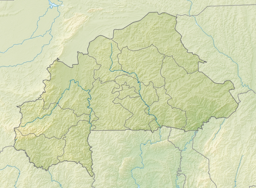
| Région | Cascades | |
| Province | Léraba | |
| Géologie | ||
| Roches | Grès | |
| Géolocalisation sur la carte : Burkina Faso
| ||
| modifier |
||
Géographie
Cette section est vide, insuffisamment détaillée ou incomplète. Votre aide est la bienvenue ! Comment faire ?
Géologie
Cette section est vide, insuffisamment détaillée ou incomplète. Votre aide est la bienvenue ! Comment faire ?
 Hutte à proximité du Tenakourou
 Panneau au sommet
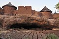 Village sur le flanc du mont


Notes et références
- « 10e édition Altitude Nahouri : encore un kenyan au sommet du pic », Faso@Actu, 26 juin 2018.
Article connexe
- Pic de Nahouri, autre sommet important du pays à 447 m
 Portail de la montagne
  Portail du Burkina Faso
На других языках
[de] Tena Kourou
Der Tena Kourou (Ténakourou) ist mit 749 m der höchste Berg Burkina Fasos. Er liegt in einem Sandsteintafelland an der Grenze zu Mali im Westen des Landes.[en] Mount Tenakourou
Mount Tenakourou (also spelled Ténakourou, Tena Kourou or Téna Kourou) is the highest point in Burkina Faso. It is a hill situated on the border of the Cascades Region of Burkina Faso and the Sikasso Region of the country of Mali, not far from the source of the Black Volta. It has an elevation of 747 metres (2,451 ft). The hill is part of Burkina Faso's South-Western Paleozoic sandstone massif[2][3] and was formed through the incline of the country's Central Plateau.[4] The surrounding terrain is relatively flat and around 400 metres (1,312 ft) high.[5][es] Tenakourou
Tenakourou[1] es el punto culminante del país africano de Burkina Faso, a 747 metros. Se encuentra cerca justo en la frontera con Malí. Como su altitud estaba cerca de una cumbre cercana, en Malí, un montón de piedras fue utilizado para marcar una diferencia mayor. Administrativamente hace parte de la Provincia de Léraba en la Región Cascades.- [fr] Tenakourou
Текст в блоке "Читать" взят с сайта "Википедия" и доступен по лицензии Creative Commons Attribution-ShareAlike; в отдельных случаях могут действовать дополнительные условия.
Другой контент может иметь иную лицензию. Перед использованием материалов сайта WikiSort.org внимательно изучите правила лицензирования конкретных элементов наполнения сайта.
Другой контент может иметь иную лицензию. Перед использованием материалов сайта WikiSort.org внимательно изучите правила лицензирования конкретных элементов наполнения сайта.
2019-2026
WikiSort.org - проект по пересортировке и дополнению контента Википедии
WikiSort.org - проект по пересортировке и дополнению контента Википедии