geo.wikisort.org - Montagne
Taounchits est un stratovolcan du Kamtchatka, en Russie. Il s'élève à 2 353 mètres d'altitude à l'ouest de l'Ouzon.
Cet article est une ébauche concernant la Russie, la montagne et le volcanisme.
Vous pouvez partager vos connaissances en l’améliorant (comment ?) selon les recommandations des projets correspondants.
| Taounchits | |||
 Vue du Taounchits. | |||
| Géographie | |||
|---|---|---|---|
| Altitude | 2 353 m[1] | ||
| Massif | Chaîne Orientale (Kamtchatka) | ||
| Coordonnées | 54° 31′ 41″ nord, 159° 48′ 16″ est[1] | ||
| Administration | |||
| Pays | |||
| Kraï | Kamtchatka | ||
| Géologie | |||
| Âge | 39 000 ans | ||
| Roches | Andésite, andésite basaltique | ||
| Type | Volcan de subduction | ||
| Morphologie | Stratovolcan | ||
| Activité | Endormi | ||
| Dernière éruption | VIe siècle av. J.-C. | ||
| Code GVP | 300160 | ||
| Observatoire | Institut de volcanologie et de sismologie | ||
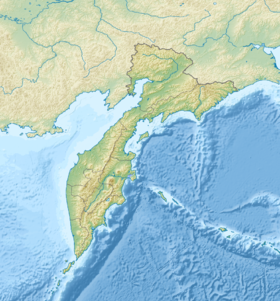
| Géolocalisation sur la carte : kraï du Kamtchatka
Géolocalisation sur la carte : Russie
| |||
| modifier |
|||

Notes et références
- Visualisation sur la carte topographique locale.
Article connexe
 Portail de la Russie
  Portail de la Sibérie
  Portail de la montagne
  Portail du volcanisme
На других языках
[en] Taunshits
Taunshits (Russian: Тауншиц) is a stratovolcano located in the eastern part of the Kamchatka Peninsula, Russia.- [fr] Taounchits
[ru] Тауншиц
Тауншиц[2] — вулкан, расположенный к юго-западу от Кроноцкого озера, на полуострове Камчатка, Россия[3].Текст в блоке "Читать" взят с сайта "Википедия" и доступен по лицензии Creative Commons Attribution-ShareAlike; в отдельных случаях могут действовать дополнительные условия.
Другой контент может иметь иную лицензию. Перед использованием материалов сайта WikiSort.org внимательно изучите правила лицензирования конкретных элементов наполнения сайта.
Другой контент может иметь иную лицензию. Перед использованием материалов сайта WikiSort.org внимательно изучите правила лицензирования конкретных элементов наполнения сайта.
2019-2025
WikiSort.org - проект по пересортировке и дополнению контента Википедии
WikiSort.org - проект по пересортировке и дополнению контента Википедии