geo.wikisort.org - Montagne
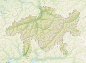
Le Rheinwaldhorn (littéralement « Corne de la forêt du Rhin ») ou Adula est un sommet du massif des Alpes lépontines à 3 402 m d'altitude, à cheval sur les cantons du Tessin et des Grisons, en Suisse.
Pour les articles homonymes, voir Rhein.
| Rheinwaldhorn | |
 Le Rheinwaldhorn. | |
| Géographie | |
|---|---|
| Altitude | 3 402 m[1] |
| Massif | Alpes lépontines (Alpes) |
| Coordonnées | 46° 29′ 37″ nord, 9° 02′ 24″ est[1] |
| Administration | |
| Pays | |
| Cantons | Tessin Grisons |
| District Régions |
Blenio Surselva, Viamala |
| Ascension | |
| Première | 1789 par Placidus a Spescha |
| modifier |
|
Il est par ailleurs le point culminant de l'Adula (partie orientale des Alpes lépontines, à l'est du col du Saint-Gothard), et de tout le canton du Tessin. Les sommets les plus proches sont le Güferhorn au nord-est et le Vogelberg au sud-est.
Notes et références
- Visualisation sur Swisstopo.
Lien externe
- Ressource relative à la géographie :
- Portail de la montagne
- Portail des Alpes
- Portail de la géographie de la Suisse
- Portail du canton du Tessin
- Portail du canton des Grisons
На других языках
[de] Rheinwaldhorn
Das Rheinwaldhorn, italienisch entsprechend Adula oder Pizzo del Cadabi, rätoromanisch Piz Valrain bzw. Piz Valragn oder Pez Valrein[1], ist mit 3402 m ü. M. der höchste Berg der geographisch weiteren Adula-Alpen. Weitere heute ungebräuchliche Namen waren Rheinwaldspitze, Schneehorn, Adulahorn und Moschelhorn.[2] Zu römischen Zeiten erwähnen sowohl Tacitus als auch Strabo und Ptolemäus „ADULA MONS“, es ist aber unklar, ob hier die heutige Adula-Gruppe gemeint ist oder der Name damals noch eine weiträumigere Bedeutung hatte. Das Gebiet wurde als Ursprung des Rheins angesehen.[3][en] Rheinwaldhorn
The Rheinwaldhorn (Italian: Adula) is the highest point in the Swiss canton of Ticino at 3,402 metres above sea level. It lies on the border between the cantons of Graubünden and Ticino, in the Adula massif, part of the St. Gotthard massif of the Lepontine Alps in southern Switzerland.- [fr] Rheinwaldhorn
[it] Adula
L'Adula (3.402 m s.l.m., Rheinwaldhorn in tedesco e Piz Valragn in romancio) è la vetta più alta del Canton Ticino. Si trova al confine tra esso e il Canton Grigioni.[ru] Райнвальдхорн
Райнвальдхорн[источник не указан 2461 день] или Рейнвальдхорн[2] (нем. Rheinwaldhorn; итал. Adula; фр. Adula) — гора высотой 3402 м, расположенная в Лепонтинских Альпах, высшая точка кантона Тичино Швейцарии. Расположена на границе кантонов Граубюнден и Тичино в массиве Адула.Текст в блоке "Читать" взят с сайта "Википедия" и доступен по лицензии Creative Commons Attribution-ShareAlike; в отдельных случаях могут действовать дополнительные условия.
Другой контент может иметь иную лицензию. Перед использованием материалов сайта WikiSort.org внимательно изучите правила лицензирования конкретных элементов наполнения сайта.
Другой контент может иметь иную лицензию. Перед использованием материалов сайта WikiSort.org внимательно изучите правила лицензирования конкретных элементов наполнения сайта.
2019-2025
WikiSort.org - проект по пересортировке и дополнению контента Википедии
WikiSort.org - проект по пересортировке и дополнению контента Википедии


