geo.wikisort.org - Montagne
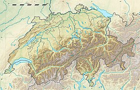
La pointe de Paray est un sommet des Préalpes fribourgeoises située en Suisse, entre le canton de Fribourg et le canton de Vaud.
| Pointe de Paray | |
 La pointe de Paray. | |
| Géographie | |
|---|---|
| Altitude | 2 374 m[1] |
| Massif | Alpes bernoises (Alpes) |
| Coordonnées | 46° 30′ 47″ nord, 7° 08′ 13″ est[1] |
| Administration | |
| Pays | |
| Cantons | Fribourg Vaud |
| Districts | Gruyère Riviera-Pays-d’Enhaut |
| modifier |
|
Géographie
La pointe de Paray culmine à 2 374 m d'altitude. Le versant vaudois du sommet est inclus dans le district franc fédéral les Bimis-Ciernes Picat. La montagne est intégrée au parc naturel régional Gruyère Pays-d'Enhaut.
Notes et références
- Visualisation sur Swisstopo.
- Portail de la montagne
- Portail des Alpes
- Portail de la géographie de la Suisse
- Portail du canton de Vaud
- Portail du canton de Fribourg
На других языках
[en] Pointe de Paray
The Pointe de Paray is a mountain of the Swiss Prealps, located on the border between the cantons of Fribourg and Vaud. It has a height of 2,375 metres above sea level, making it both the third highest summit of the Vanil Noir massif and the canton of Fribourg. The mountain lies approximately halfway between the Vanil de l'Ecri and the Gros Perré.- [fr] Pointe de Paray
Текст в блоке "Читать" взят с сайта "Википедия" и доступен по лицензии Creative Commons Attribution-ShareAlike; в отдельных случаях могут действовать дополнительные условия.
Другой контент может иметь иную лицензию. Перед использованием материалов сайта WikiSort.org внимательно изучите правила лицензирования конкретных элементов наполнения сайта.
Другой контент может иметь иную лицензию. Перед использованием материалов сайта WikiSort.org внимательно изучите правила лицензирования конкретных элементов наполнения сайта.
2019-2025
WikiSort.org - проект по пересортировке и дополнению контента Википедии
WikiSort.org - проект по пересортировке и дополнению контента Википедии


