geo.wikisort.org - Montagne
Le Piz de Puez (Puezspitzen en allemand) est une montagne des Dolomites comprenant deux sommets, dans le Tyrol du Sud. Le sommet oriental est le point culminant du groupe du Puez, à 2 913 m, tandis que le sommet occidental se situe à 2 909 m.
Cet article est une ébauche concernant la montagne et le Trentin-Haut-Adige.
Vous pouvez partager vos connaissances en l’améliorant (comment ?) selon les recommandations des projets correspondants.
| Piz de Puez | ||||
 Vue du sud. | ||||
| Géographie | ||||
|---|---|---|---|---|
| Altitude | 2 913 m[1] | |||
| Massif | Dolomites (Alpes) | |||
| Coordonnées | 46° 35′ 53″ nord, 11° 48′ 50″ est[1] | |||
| Administration | ||||
| Pays | ||||
| Région à statut spécial | Trentin-Haut-Adige | |||
| Province autonome | Bolzano | |||
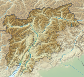
| Géolocalisation sur la carte : province autonome de Bolzano
Géolocalisation sur la carte : Trentin-Haut-Adige
Géolocalisation sur la carte : Italie
| ||||
| modifier |
||||


Notes et références
- Visualisation sur le géoportail italien.
 Portail de la montagne
  Portail des Alpes
  Portail du Trentin-Haut-Adige
На других языках
[de] Puezspitzen
Die Puezspitzen (ladinisch Pizes de Puez) sind ein zweigipfliger Berg in den Südtiroler Dolomiten. Der Westgipfel, die Westliche Puezspitze, ist mit 2918 m der höchste Punkt der Puezgruppe, während der Ostgipfel, die Östliche Puezspitze, in etwa 300 m Entfernung mit 2913 m etwas niedriger ist.- [fr] Piz de Puez
[it] Piz de Puez
Il Piz de Puez (2.918 m s.l.m.) è la montagna più alta del Gruppo del Puez nelle Dolomiti. Si trova nella provincia autonoma di Bolzano. Si trova all'interno del Parco naturale Puez-Odle. La montagna può essere salita partendo dal Rifugio Puez in circa un'ora.[1]Текст в блоке "Читать" взят с сайта "Википедия" и доступен по лицензии Creative Commons Attribution-ShareAlike; в отдельных случаях могут действовать дополнительные условия.
Другой контент может иметь иную лицензию. Перед использованием материалов сайта WikiSort.org внимательно изучите правила лицензирования конкретных элементов наполнения сайта.
Другой контент может иметь иную лицензию. Перед использованием материалов сайта WikiSort.org внимательно изучите правила лицензирования конкретных элементов наполнения сайта.
2019-2026
WikiSort.org - проект по пересортировке и дополнению контента Википедии
WikiSort.org - проект по пересортировке и дополнению контента Википедии