geo.wikisort.org - Montagne
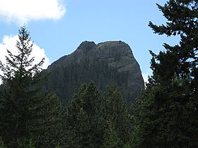
Pilot Rock est un sommet culminant à 1 801 mètres d'altitude dans la chaîne des Cascades, dans le Sud-Ouest de l'Oregon aux États-Unis. Il s'agit d'un neck.
Pour les articles homonymes, voir Pilot Rock (Arizona) et Pilot Rock (municipalité).
Ne doit pas être confondu avec Pilot Butte.
| Pilot Rock | |||
 Vue de Pilot Rock. | |||
| Géographie | |||
|---|---|---|---|
| Altitude | 1 801 m[1] | ||
| Massif | Chaîne des Cascades | ||
| Coordonnées | 42° 01′ 50″ nord, 122° 33′ 39″ ouest[1] | ||
| Administration | |||
| Pays | |||
| État | Oregon | ||
| Comté | Jackson | ||
| Ascension | |||
| Voie la plus facile | Sentier depuis le Pacific Crest Trail, à l'ouest | ||
| Géologie | |||
| Âge | 25,6 millions d'années | ||
| Roches | Andésite | ||
| Type | Neck | ||
| Géolocalisation sur la carte : États-Unis
Géolocalisation sur la carte : Oregon
| |||
| modifier |
|||
Notes et références
- Visualisation sur l'USGS.
Liens externes
- Ressources relatives à la géographie :
- Portail de la montagne
- Portail du volcanisme
- Portail de l’Oregon
На других языках
[en] Pilot Rock (Oregon)
Pilot Rock is a prominent volcanic plug located in the western Cascade Range near the east end of the Siskiyou Mountains, just east of the Siskiyou Summit near Ashland, Oregon. Rising thousands of feet above the Shasta and Rogue valleys, it is a landmark distinguishable from over 40 miles (64 km) away. At 25.6 million years old, it is one of the oldest formations of the Cascade Range. The rock is protected by the Cascade–Siskiyou National Monument and the Soda Mountain Wilderness. Several trails pass near Pilot Rock, including the Pacific Crest Trail.- [fr] Pilot Rock
Текст в блоке "Читать" взят с сайта "Википедия" и доступен по лицензии Creative Commons Attribution-ShareAlike; в отдельных случаях могут действовать дополнительные условия.
Другой контент может иметь иную лицензию. Перед использованием материалов сайта WikiSort.org внимательно изучите правила лицензирования конкретных элементов наполнения сайта.
Другой контент может иметь иную лицензию. Перед использованием материалов сайта WikiSort.org внимательно изучите правила лицензирования конкретных элементов наполнения сайта.
2019-2025
WikiSort.org - проект по пересортировке и дополнению контента Википедии
WikiSort.org - проект по пересортировке и дополнению контента Википедии

