geo.wikisort.org - Montagne
Le pic Simón Bolívar est le second sommet le plus élevé de Colombie. Ce pic qui fait partie du massif de la Sierra Nevada de Santa Marta mesure 5 774 m et est situé à une cinquantaine de kilomètres de la côte donnant sur la mer des Caraïbes.
Ne doit pas être confondu avec Pico Bolívar.
| Pic Simón Bolívar | ||
 Vue du pic Cristóbal Colón (au centre) et du pic Simón Bolívar (arrière-plan à droite) depuis le nord. | ||
| Géographie | ||
|---|---|---|
| Altitude | 5 774 m | |
| Massif | Sierra Nevada de Santa Marta (Andes) |
|
| Coordonnées | 10° 50′ 04″ nord, 73° 41′ 31″ ouest | |
| Administration | ||
| Pays | ||
| Département | Magdalena | |
| Ascension | ||
| Première | 1939, par Erwin Kraus, Guido Pilcher et Enrico Praolini | |
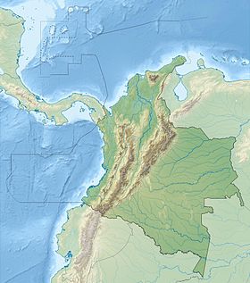
| Géolocalisation sur la carte : sierra Nevada de Santa Marta
| ||
| modifier |
||
Il est assez difficile de déterminer si ce pic est moins haut que son jumeau, le pic Cristóbal Colón mais dans la majorité des ouvrages le pic Cristóbal Colón est donné comme plus élevé, la différence entre les deux étant d'un mètre.
Notes et références
- Portail de la montagne
- Portail de la Colombie
На других языках
[de] Pico Simón Bolívar
Der Pico Simón Bolívar ist zusammen mit dem Pico Cristóbal Colón der höchste Berg Kolumbiens. Beide Gipfel liegen im Gebirge der Sierra Nevada de Santa Marta und sind 5775 m hoch.[en] Pico Simón Bolívar
Pico Simón Bolívar is the second highest mountain in Colombia, with an estimated height of 5,730 metres (18,800 ft). Pico Bolívar and the neighbouring summit of Pico Cristóbal Colón are the two highest peaks in Colombia and are very nearly equal in elevation. The difference in elevation is estimated to be only one or two metres.[2] One or other of these peaks is therefore the fifth most prominent in the world (see list of peaks by prominence). The nearest peak that is higher is Cayambe, some 1,288 kilometres (800 mi) away. There is a permanent snowcap on this peak and on the nearby mountains. It is part of the Sierra Nevada de Santa Marta range, along with Pico Cristóbal Colón. The peak is named after Simón Bolívar.[es] Pico Simón Bolívar
El pico Simón Bolívar es una montaña con nieves perpetuas que forma parte de la Sierra Nevada de Santa Marta, en el norte de Colombia. El pico Simón Bolívar y el pico Cristóbal Colón son picos gemelos, lo cual quiere decir que tienen la misma altura de 5.775 m,[cita requerida] y por lo tanto ambos son las montañas más altas de Colombia, pero usualmente se escoge al pico Cristóbal Colón para representar a Colombia, ya que es más fácil de esta manera diferenciar entre el pico más alto de Venezuela, que es el pico Bolívar[cita requerida]. Datos provistos por la misión SRTM señalan que el pico posee una altitud cercana a los 5.700 msnm, menor a la tradicionalmente aceptada.[1]- [fr] Pic Simón Bolívar
[it] Picco Simón Bolívar
Il picco Simón Bolívar (5 774 m s.l.m. - in spagnolo Pico Simón Bolívar) è la seconda montagna più alta della Colombia.[ru] Пик Симона Боливара
Не следует путать с пиком Боливар (4978 м) — высочайшей вершиной Венесуэлы.Текст в блоке "Читать" взят с сайта "Википедия" и доступен по лицензии Creative Commons Attribution-ShareAlike; в отдельных случаях могут действовать дополнительные условия.
Другой контент может иметь иную лицензию. Перед использованием материалов сайта WikiSort.org внимательно изучите правила лицензирования конкретных элементов наполнения сайта.
Другой контент может иметь иную лицензию. Перед использованием материалов сайта WikiSort.org внимательно изучите правила лицензирования конкретных элементов наполнения сайта.
2019-2025
WikiSort.org - проект по пересортировке и дополнению контента Википедии
WikiSort.org - проект по пересортировке и дополнению контента Википедии

