geo.wikisort.org - Montagne
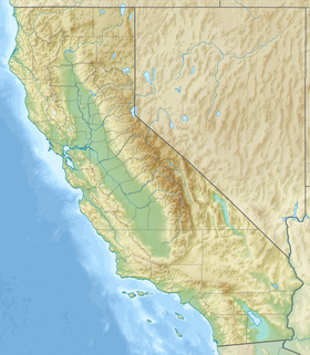
Le pic Parsons (en anglais : Parsons Peak) est un sommet de la Sierra Nevada, aux États-Unis. Il culmine à 3 702 mètres d'altitude à la frontière entre le comté de Madera et le comté de Tuolumne, en Californie. Son sommet se trouve en outre à peu de distance de la limite du comté de Mariposa, duquel ses pentes sont le point culminant. Il relève de la Yosemite Wilderness, dans le parc national de Yosemite.
Pour les articles homonymes, voir Parsons.
| Pic Parsons | |||
 |
|||
| Géographie | |||
|---|---|---|---|
| Altitude | 3 702 m[1] | ||
| Massif | Chaînon Cathedral (Sierra Nevada) | ||
| Coordonnées | 37° 46′ 37″ nord, 119° 18′ 28″ ouest[1] | ||
| Administration | |||
| Pays | |||
| État | Californie | ||
| Comtés | Madera, Tuolumne | ||
| Ascension | |||
| Première | Marion Randall Parsons avant 1931 | ||
| Géolocalisation sur la carte : États-Unis
Géolocalisation sur la carte : Californie
| |||
| modifier |
|||
Notes et références
- Visualisation sur l'USGS.
Liens externes
- Ressources relatives à la géographie :
- Portail de la montagne
- Portail du parc national de Yosemite
На других языках
[de] Parsons Peak (Kalifornien)
Parsons Peak ist ein Berg im Yosemite National Park, in der Cathedral Range der kalifornischen Sierra Nevada. Der Gipfel liegt auf der Grenze zwischen dem Madera County und dem Tuolumne County. Ein Grat nordwestlich des Gipfels führt zum gemeinsamen Grenzpunkt mit dem Mariposa County, der gleichzeitig der höchste Punkt dieses Countys ist.[2] Auf Grund der Höhenlage fallen die meisten Niederschläge als Schnee.[3][en] Parsons Peak
Parsons Peak is a mountain in Yosemite National Park and the Cathedral Range of California's Sierra Nevada. The peak, located on the Madera–Tuolumne county line, rises to an elevation of 12,153 feet (3,704 m). The mountain has a ridge extending northwest from the summit. On this ridge is a point, referred to as Parsons Peak-Northwest Ridge, which rises to an elevation of about 8,848 feet (2,697 m) and at this point the boundaries of Mariposa, Tuolumne, and Madera counties meet. This point is the highest point in Mariposa County.[4] The summit of Parsons Peak is just outside Mariposa County.- [fr] Pic Parsons
Текст в блоке "Читать" взят с сайта "Википедия" и доступен по лицензии Creative Commons Attribution-ShareAlike; в отдельных случаях могут действовать дополнительные условия.
Другой контент может иметь иную лицензию. Перед использованием материалов сайта WikiSort.org внимательно изучите правила лицензирования конкретных элементов наполнения сайта.
Другой контент может иметь иную лицензию. Перед использованием материалов сайта WikiSort.org внимательно изучите правила лицензирования конкретных элементов наполнения сайта.
2019-2025
WikiSort.org - проект по пересортировке и дополнению контента Википедии
WikiSort.org - проект по пересортировке и дополнению контента Википедии

