geo.wikisort.org - Montagne
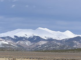
Le pic Culebra, en anglais Culebra Peak, est un sommet montagneux américain dans le comté de Costilla, au Colorado. Il culmine à 4 282 mètres d'altitude dans le chaînon Culebra.
Pour les articles homonymes, voir Culebra.
| Pic Culebra | |||
 Vue du sommet depuis le sud de San Luis. | |||
| Géographie | |||
|---|---|---|---|
| Altitude | 4 282 m[1] | ||
| Massif | Chaînon Culebra (monts Sangre de Cristo, Rocheuses) | ||
| Coordonnées | 37° 07′ 20″ nord, 105° 11′ 08″ ouest[1] | ||
| Administration | |||
| Pays | |||
| État | Colorado | ||
| Comté | Costilla | ||
| Géolocalisation sur la carte : Colorado
Géolocalisation sur la carte : États-Unis
| |||
| modifier |
|||
Notes et références
- Visualisation sur l'USGS.
Liens externes
- Ressources relatives à la géographie :
- Portail de la montagne
- Portail du Colorado
На других языках
[en] Culebra Peak
Culebra Peak is the highest summit of the Culebra Range of the Sangre de Cristo Mountains in the Rocky Mountains of North America. The prominent 14,053-foot (4,283 m) fourteener is located on private land, 14.2 miles (22.8 km) east-southeast (bearing 113°) of the Town of San Luis in Costilla County, Colorado, United States.[1][2] Culebra Peak is the southernmost fourteener in the Rocky Mountains.- [fr] Pic Culebra
Текст в блоке "Читать" взят с сайта "Википедия" и доступен по лицензии Creative Commons Attribution-ShareAlike; в отдельных случаях могут действовать дополнительные условия.
Другой контент может иметь иную лицензию. Перед использованием материалов сайта WikiSort.org внимательно изучите правила лицензирования конкретных элементов наполнения сайта.
Другой контент может иметь иную лицензию. Перед использованием материалов сайта WikiSort.org внимательно изучите правила лицензирования конкретных элементов наполнения сайта.
2019-2025
WikiSort.org - проект по пересортировке и дополнению контента Википедии
WikiSort.org - проект по пересортировке и дополнению контента Википедии

